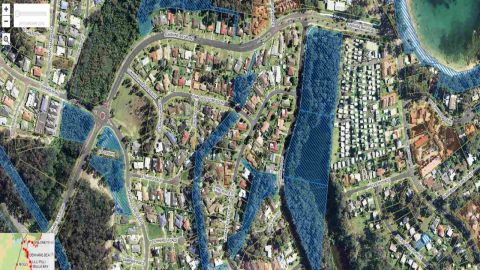
Land-mapping
If you're looking to build or buy a property in Eurobodalla, our land-mapping tool will help you explore key details about a parcel of land so you can make an informed decision.
What you'll find using our tool
Use the interactive tool to view:
- Property details: parcel title, lot size.
- Planning controls: building height limits, town planning zones and overlays.
- Environmental features: acid sulphate soils, threatened ecological communities, adopted flood studies.
- Development restrictions: bushfire-prone land, coastal management overlays, flying-fox habitats.
- Infrastructure and landscape: public infrastructure, landscape classifications.
- Mapping layers: aerial base maps, biodiversity and heritage overlays.
Other mapping tools
You can also use NSW Planning Portal's ePlanning tool to check what type of development is allowed on a property. It includes:
- land zoning information
- development control plans (DCPs)
- state environmental planning policies (SEPPs)
- bushfire and flood risk data.
Changes to land zones in NSW
As part of the Department of Planning, Housing and Infrastructure's (DPHI) employment zones reform, employment zones have replaced traditional business and industrial zones:
- Business and industrial zones B1, B2, B4, B5 and IN1 are now employment zones E1, E2, E3, E4, and MU1.
- These changes aim to support evolving business needs, attract investment, and create jobs.
- Effective from: 1 December 2022
DPHI have also renamed environment protection zones:
- Zones E1, E2, E3 or E4 are now conservation zones C1, C2, C3 or C4.
- Effective from: 1 December 2021
- Learn more in the Standard Instrument (Local Environmental Plans) Amendment (Land Use Zones) Order 2021.
Contact us
For more information, contact our Development Help Desk:
- T: 02 4474 1231
- E: Council's Development Help Desk
- Visit our customer service centre at the corner of Vulcan Street and Campbell Street, Moruya, Monday to Friday between 8.30am and 4.30pm.