Flood studies
Local councils in New South Wales are responsible for managing flood-prone land.
We work with the Department of Planning, Housing and Infrastructure to develop flood risk management studies. These studies help us understand the risks of flooding and develop strategies to reduce those risks.
The NSW Flood Risk Management Manual outlines a process to manage flood risk in NSW.
A flood study is the first step in the flood risk management process. It is followed by a flood risk management study and a flood risk management plan. These studies develop detailed strategies to reduce the risks of flooding.
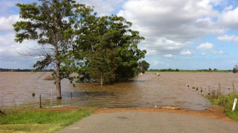
A flood study is a technical project that uses historical data and computer models to simulate flood events. The study identifies the depth, velocity, and extent of flooding. It also maps the areas that are most likely to be flooded.
The results of the flood study are used to inform planning decisions through a flood risk management study. They can help us identify areas that are not suitable for development and to develop strategies to protect people and property from flooding.
Flood risk management studies can be used to:
- identify areas most likely to be flooded, which can help develop zoning regulations that restrict development
- develop flood maps that property owners can use to assess the risks of flooding
- develop flood mitigation strategies, which can include measures such as levees or dams.
Flood Risk Management Process
- Data collection:
Compiling existing data and collecting additional data. This us usually done by consultants appointed by Council. - Flood study:
Usually undertaken by consultants appointed by Council, a flood study defines the nature and extent of the flood problem. - Flood Risk Management Study:
Usually carried out by consultants appointed by Council, a risk management study determines options in consideration of social, ecological and economic factors relating to flood risk. - Flood Risk Management Plan:
We publicly exhibit preferred options for managing flood risks. These options can be revised based on the responses and feedback we receive. These plans are formally approved by Council after public exhibition and any necessary revisions following public comments. - Plan implementation:
We implement flood response and property modification measures, which can include mitigation works, planning controls, flood warnings, flood readiness and response plans, environmental rehabilitation, ongoing data collection and monitoring.
Funding
Studies are completed as grant funding and resources become available.
Adopted flood studies
- Batemans Bay Urban Creeks Flood Study
- Moruya Floodplain Management Plan
- Tomakin, Mossy Point and Mogo Flood Study
- Wagonga Inlet, Kianga and Dalmeny Flood Study
Flood studies in progress
- Batemans Bay Urban Creeks Flood Risk Management Study and Plan
- Moruya Flood Risk Management Study and Plan
- Wagonga Inlet, Dalmeny, Kianga Flood Risk Management Study and Plan (Narooma Coastal Inlets)
More information
For more information, contact Council's Coastal Management Planner:
- T: 02 4474 1000
- E: Council@esc.nsw.gov.au