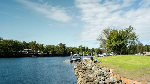
Sea level rise
Sea level rise is an increase in the average water level of the ocean. Coastal residents will, over time, experience higher tides and witness changes to the coastal and estuarine environments.
On this page, we provide answers to common questions about sea level rise, what it means for you and what Council is doing.
How Council is planning for sea level rise
We recognise that sea level rise is a serious global problem that will require a response by all levels of government.
We met our legal responsibility to consider sea level rise by adopting the Interim Coastal Hazard Adaptation Code (the interim code) on 24 February 2015. The interim code has now been replaced by the Eurobodalla Coastal Hazard Code (the code). The code recognises the potential long-term impacts of sea level rise and the need for appropriate planning responses to ensure that we facilitate economic activity and development that is resilient.
The code has a role in providing information to the community about potential current exposure to coastal hazards or future exposure to sea level rise. Having this information available allows landowners or potential investors to identify the risks and build resilience over the life of their investments.
In 2014, Council adopted a new regional approach to planning for sea level rise that included a more flexible approach to how development was assessed.
The South Coast Regional Sea Level Rise Planning and Policy Response is a partnership project with Shoalhaven City Council to develop a regional approach to how sea level rise will be considered by our strategic plans and development assessment processes. The approach was adopted at the Ordinary Council Meeting on 25 November 2014 and will guide ongoing investigations into the impacts of coastal and flood hazards.
The report was prepared by independent consultants with assistance from a Technical Advisory Committee consisting of the partner councils and experts from the Office of Environment and Heritage.
Why we have coastal development guidelines
There is a legal requirement to consider sea level rise when making policy, planning and development decisions. The code allows Council to meet its legal and planning obligations to recognise sea level rise. The interim code will be replaced following completion of a Coastal Management Program.
How much sea level rise we plan for
We have adopted the South Coast Regional Sea Level Rise Planning and Policy Response and sea level rise projections based on the Intergovernmental Panel for Climate Change (IPCC) RCP 6.0 emissions scenario:
- 23cm sea level rise by the year 2050 (which is lower than previous State policy)
- 72cm sea level rise by the year 2100 (which is lower than previous State policy)
These projections are taken from a benchmark year of 2014.
These planning levels will be reviewed following the next assessment report issued by the IPCC. This generally occurs every five to seven years. The Fort Denison tidal records will be used to report changes to mean sea level as they arise.
How we compare to other council areas
Results from a survey at Shoalhaven City Council and Eurobodalla Council show a majority of councils in NSW continue to apply the NSW Sea Level Policy Statement (2009). The previous NSW Government advice cited that national and international projections of sea level rise along the NSW coast are for a rise of:
- 40cm by 2050
- 90cm by 2100.
These projections are taken from a benchmark year of 1990. The previous State policy needs to be adjusted to a bench mark year of 2014 to make it directly comparable to the existing Eurobodalla planning levels for sea level rise. The adjusted levels currently applied by a majority of councils is:
- 35cm by 2050
- 85cm by 2100.
The table below shows that a majority of NSW south coast councils apply higher projections for sea level rise when making policy, planning and development decisions than we do. The only exception is Shoalhaven City Council that applies a projection equal to Eurobodalla up to the planning period ending at 2050 and a lower projection for the planning period ending at 2100.
Council area | Sea level rise projections considered for planning purposes (adjusted to 2014) | |
|---|---|---|
2050 | 2100 | |
Eurobodalla | 23cm | 72cm |
Bega | 35cm | 85cm |
Shoalhaven | 23cm | 35cm |
Kiama | 35cm | 85cm |
Wollongong | 35cm | 85cm |
Protecting your home from coastal storms and sea level rise
The code does not stop property owners from applying to construct coastal protection works. Owners may choose to forward an application to protect their properties.
The Coastal Zone Emergency Action Subplan contains additional guidance on landowners' ability to construct coastal protection works.
- Coastal Zone Emergency Action Subplan
More information
- Background information about sea level rise planning in NSW and Eurobodalla Shire
- Sea level rise forum - 28 April 2014
- Clarifying data on sea level rise - clearing the confusion
Downloads
- South coast regional sea level rise policy and planning framework (6.0 MB)
- Minutes of 25 November 2014 Ordinary Meeting of Council (455.8 KB)
- Guide note for south coast regional sea level rise policy and planning framework (329.2 KB)
Contact us
For more information, contact Council's Coastal Management Planner:
- T: 02 4474 1000
- E: Council@esc.nsw.gov.au