Development assessment and sea level rise
Council adopted the Eurobodalla Coastal Hazard Code (the code) at the Ordinary Meeting of Council on 13 December 2022.
The code recognises Council's legal obligation to consider coastal hazards, and the need to plan for sea level rise when assessing some Development Applications. The code relies on the Eurobodalla Coastal Management Program to determine which properties are potentially at risk from coastal hazards and require additional detailed assessment.
What this means for Development Applications
Application of the code is to support Development Applications. If you are planning development, please read our page 'Does my development require a Development Application?' to determine if you need to lodge an application.
Coastal hazards assessment
Council officers will review the Eurobodalla Coastal Hazard Assessment to determine if coastal hazards are likely to impact the development and the land it is on. This can include:
- increase in sea level and tidal range
- soft coast erosion
- coastal flooding
- entrance behaviour
- reconfiguration of Intermittently Closed and Opening Lakes and Lagoons (ICOLLs)
- cliff and slope stability.
Risk assessment
This will determine the degree of risk that coastal hazards present to your development. The risk assessment must consider:
- information to determine if your site is within a coastal erosion risk area
- degree of exposure to immediate risk (a storm that can occur now)
- hazard category in relation to the relevant planning period
- identification of the shoreline recession rate and the zone of reduced foundation capacity (how a changing beach may impact on foundations)
- performance of infrastructure and services
- impact on existing public beach, foreshore or waterfront access and amenity (ensuring your development will not impact on public use, ownership and access to the coast)
- impact on coastal processes as a result of the development, including impacts on:
- adjoining sites
- coastal ecosystems
- public and occupant safety
- emergency response, eg, will you need to be evacuated?
Sea level rise planning levels
We currently apply the planning benchmarks outlined in the Interim Coastal Hazards Adaptation Code.
The planning benchmarks in the code for a residential development are determined based on:
- building life
- corresponding sea level rise projection for that period.
For example, the local sea level rise planning projection for the year 2065 is 34cm, measured from 2015 levels.
Coastal erosion risk areas and hazard lines
A coastal erosion risk area is land that has been identified by a study or a coastal management program as being at risk from erosion. We currently apply hazard areas identified in the Open Coast Coastal Management Program.
The boundary of the risk area may change over time under conditions of sea level rise and climate change. This boundary and how it may change over time is typically drawn on a map as a hazard line.
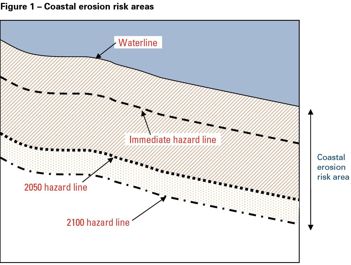
Coastal erosion risk areas are identified in studies that accord with the Coastline Management Manual and are complemented by the Coastal Risk Management Guide.
What happens next
We recommended that you organise a free pre-lodgement meeting with us if you are considering development in areas that are potentially at risk from sea level rise. The meeting will help you determine what is required before you draw-up detailed plans or engage a consulting engineer.
We can help you
Please contact us if you aren't sure if you need to comply with the Interim Coastal Hazards Adaptation Code:
- T: 02 4474 1231
- E: Council's development Help Desk