Batemans Bay Coastal Headlands Walking Trail and Observation Point upgrade
Project: a coastal walking trail linking the headlands and beaches between Batehaven and McKenzies Beach via existing natural bush tracks and lookout areas, all on public land.
Timeframe: 2021 to 2026
Status: Complete
Cost and funding: approximately $6.5m consisting of:
- $5.25m from the Bushfire Local Economic Recovery Fund, co-funded by the Australian and NSW governments
- $672,000 from Building Better Regions Fund
- $145,000 from Bushfire Regional Tourism Fund
- $75,000 from Stronger Country Communities Fund
- contributions from Rotary Club and Council
Page last updated: December 2025
Project details
We are working to:
- Build the Batemans Bay Coastal Headlands Walking Trail, a recreational feature that will connect Batehaven, Surf Beach, and Malua Bay.
- Upgrade the Observation Point lookout.
Benefits to the community:
- The trail will offer a year-round attraction that shows off Eurobodalla’s coast, diverse nature and unique Aboriginal heritage.
- Walkers can choose to hike the whole distance in a single day, wander at a more leisurely pace, or take advantage of shorter walks.
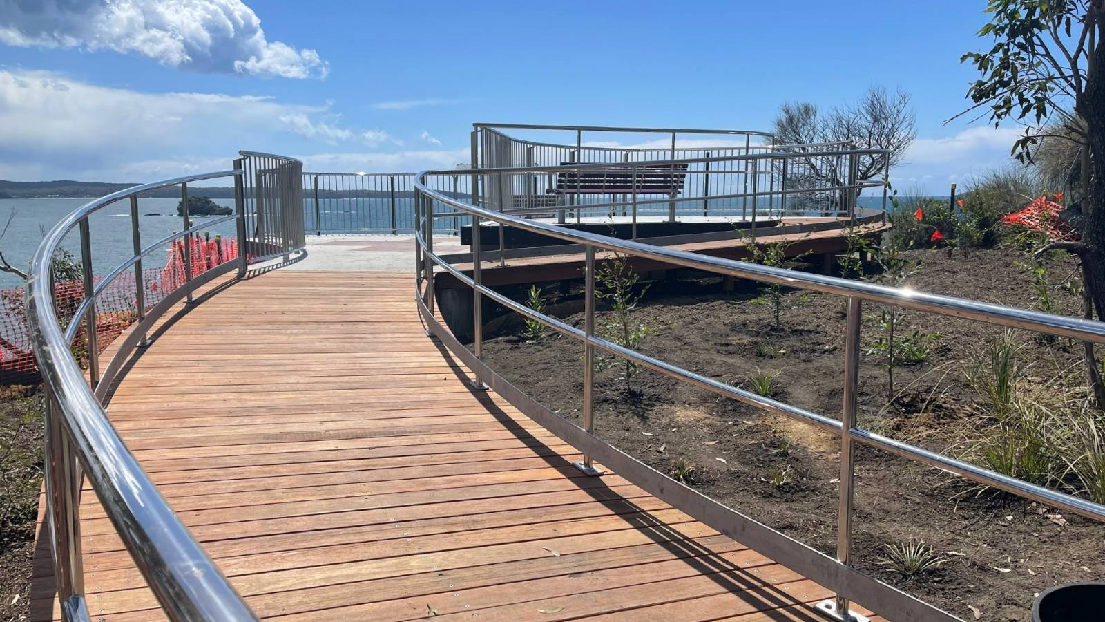
- The Observation Point upgrade will include a wheelchair-accessible viewing platform and lookout points, interpretations of Aboriginal and European cultural and historical information, car parking and picnic areas.
This project is based on a concept approved by the Council back in 2010. Significant government funding in recent years, including for bushfire recovery, brought the trails to the final planning and construction-ready phase.
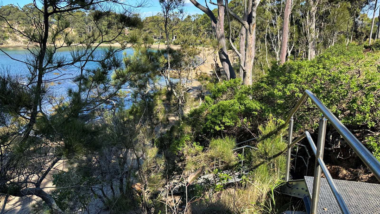
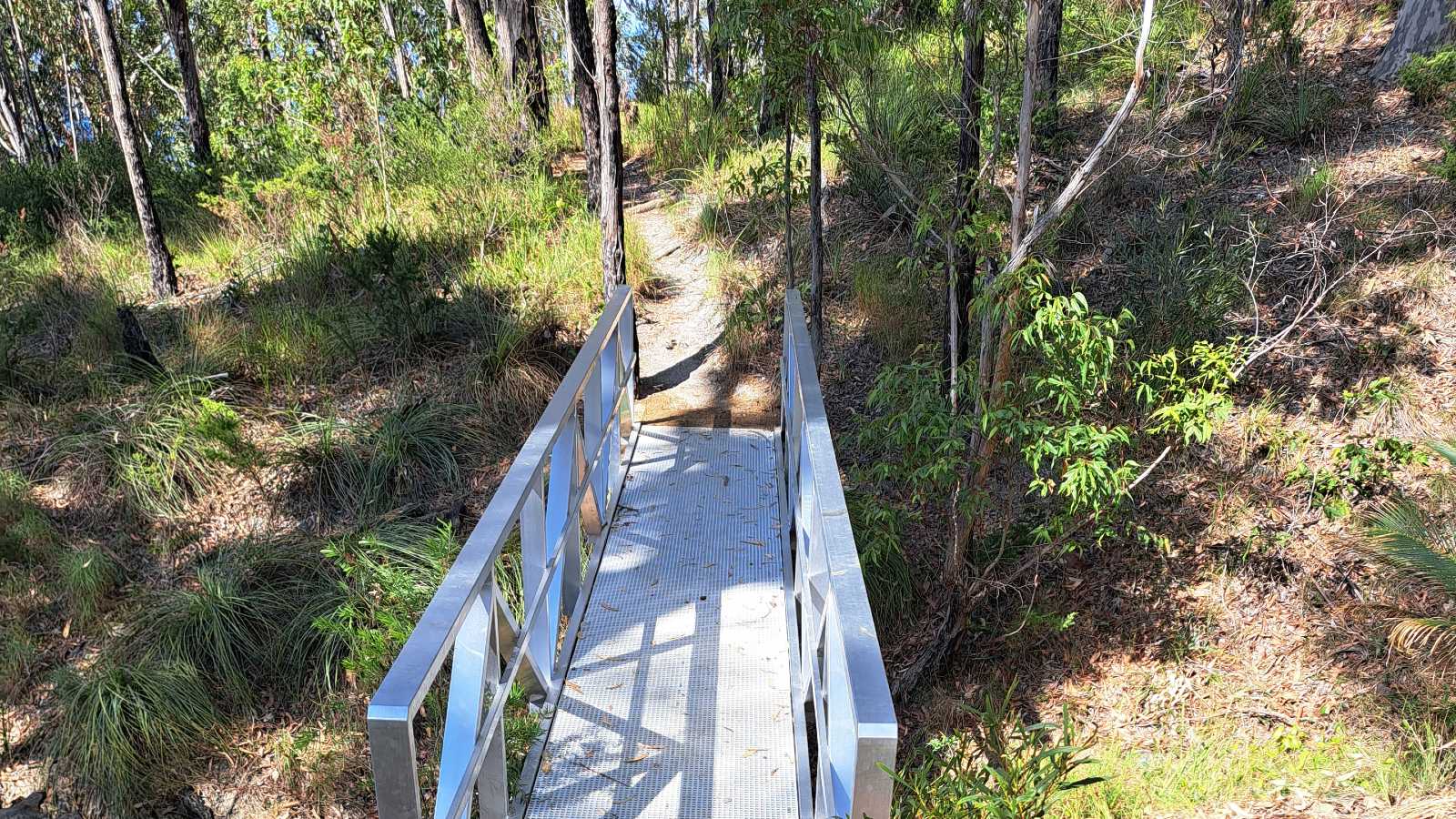
Construction will be low-impact and only where required. This will include erosion control, upgrading walkways and stairways, providing footbridges, safety barriers and information signs. We will reroute the trail around any sensitive areas and keep vegetation trimming to a minimum so we don't widen the track any more than necessary. We'll remove invasive weeds along the way and replant with native species to enhance the natural environment.
Batehaven's Observation Point will serve as a gateway to the trail. From there, the trail will continue along the headlands to McKenzies Beach. A smaller network of inland tracks will allow access during high tides and adverse swell conditions.
The trail will provide safe, year-round access to the headlands and ensure residents retain access to this community land through ongoing maintenance by Council.
The trail will navigate varying landscapes from urban areas to dense forests, and from cliff tops to the ocean foreshore.
Munjip Trail webpage
We now have a dedicated webpage to showcase everything Munjip Trail – an interactive map, videos, short walk suggestions, hiking tips, and introductions to on-trail art and available cultural tours – bringing the Trail concept to life.
- To visit the webpage: Munjip Trail
- To go straight to the new interactive map: Munjip Trail map
Updates
We have been planning these projects for some time. Here are some images of the new infrastructure and a summary of activities and milestones:
2025
In 2025 we:
- added more plants and managed vegetation
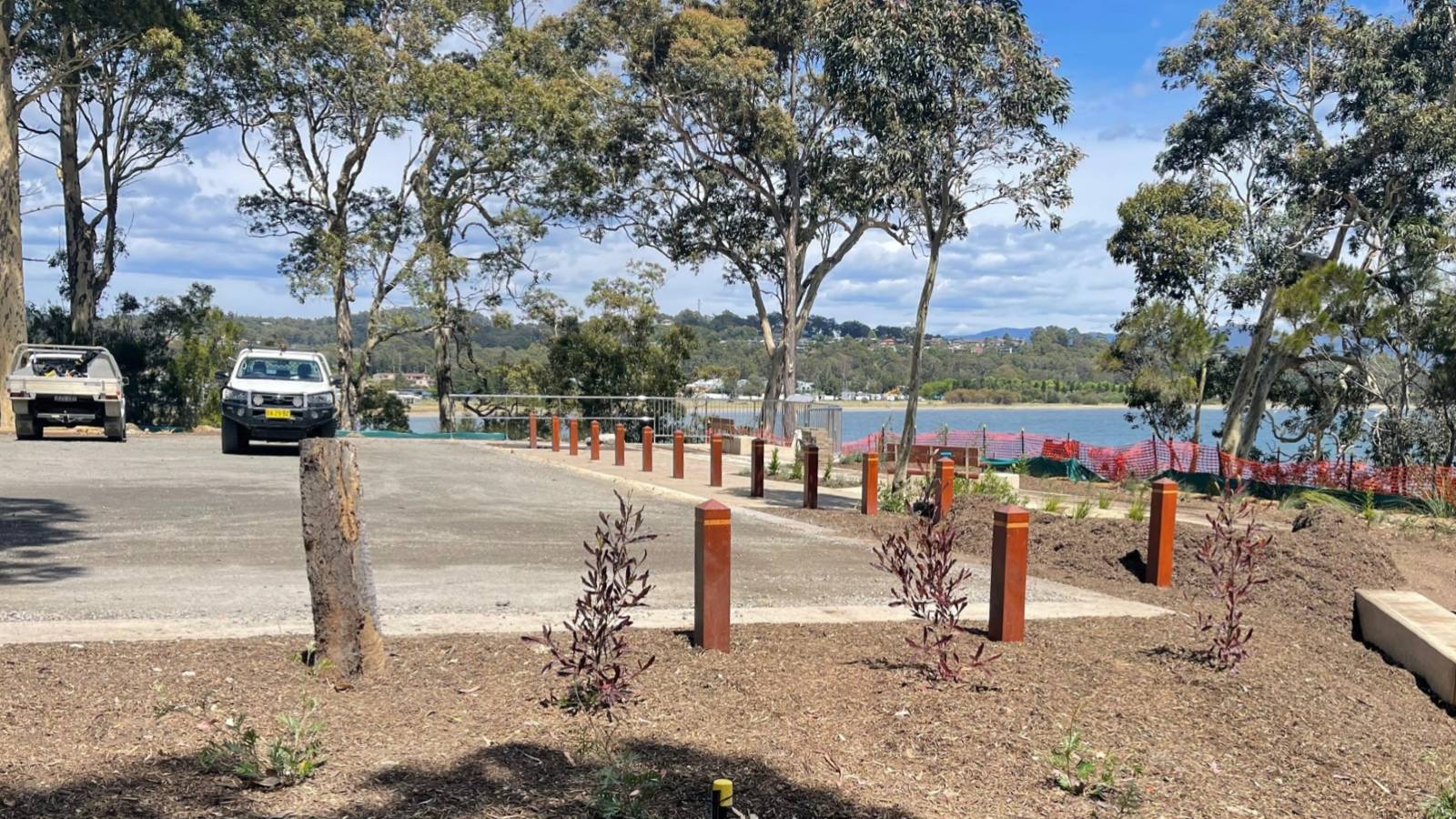
- upgraded the area around Denhams Beach car park
- installed wayfinding and interpretive signs
- provided a new website dedicated to the trail - Munjip Trail
2024
Our focus for 2024 included:
- building the remaining raised walkways, steps, seats, viewing platforms, and safety barriers
- constructing five footbridges
- creating a yarning circle at Wimbie Beach
- upgrading the toilet facilities at Mosquito Bay and Lilli Pilli
- finishing works at Observation Point
- upgrading the trail access at McKenzies Beach
- creating and enhancing informal tracks
- revegetating areas along the trail
- providing directional and interpretive signs.
Working with local Elders, the trail has been named Munjip, which means “walking together, let’s go” in dhurga language.
We are working with Aboriginal consultation groups and Aboriginal artists to finalise the interpretive signage content and arts collaborations. Integrating artwork has been a focus of the project, with art featured in our wayfinding and interpretive signage, dhurga language plates, concrete etchings, privacy screens, art murals, and audio poles.
We are working with five local yuin walbunja artists: Leanne Brook, Nigel Stewart, Bronwen Smith, Reena Slockee and Natalie Bateman. The artworks explore each artists connection to Country, drawing themes and subjects from our interpretation plan. Examples include:
- Caring for Country: sustainably living off the ocean
- Formation of the land: our diverse coastline
- Taking care of natural places: flora and fauna, our sanctuaries
- Local language and culture.
It has been a privilege to work alongside First Nations people, elders, artists, and the community to bring Aboriginal culture into the trail project. We look forward to sharing the results of these collaborations later in 2024 and hope they will enhance our community spaces, fostering a sense of belonging and connection to place.
2023
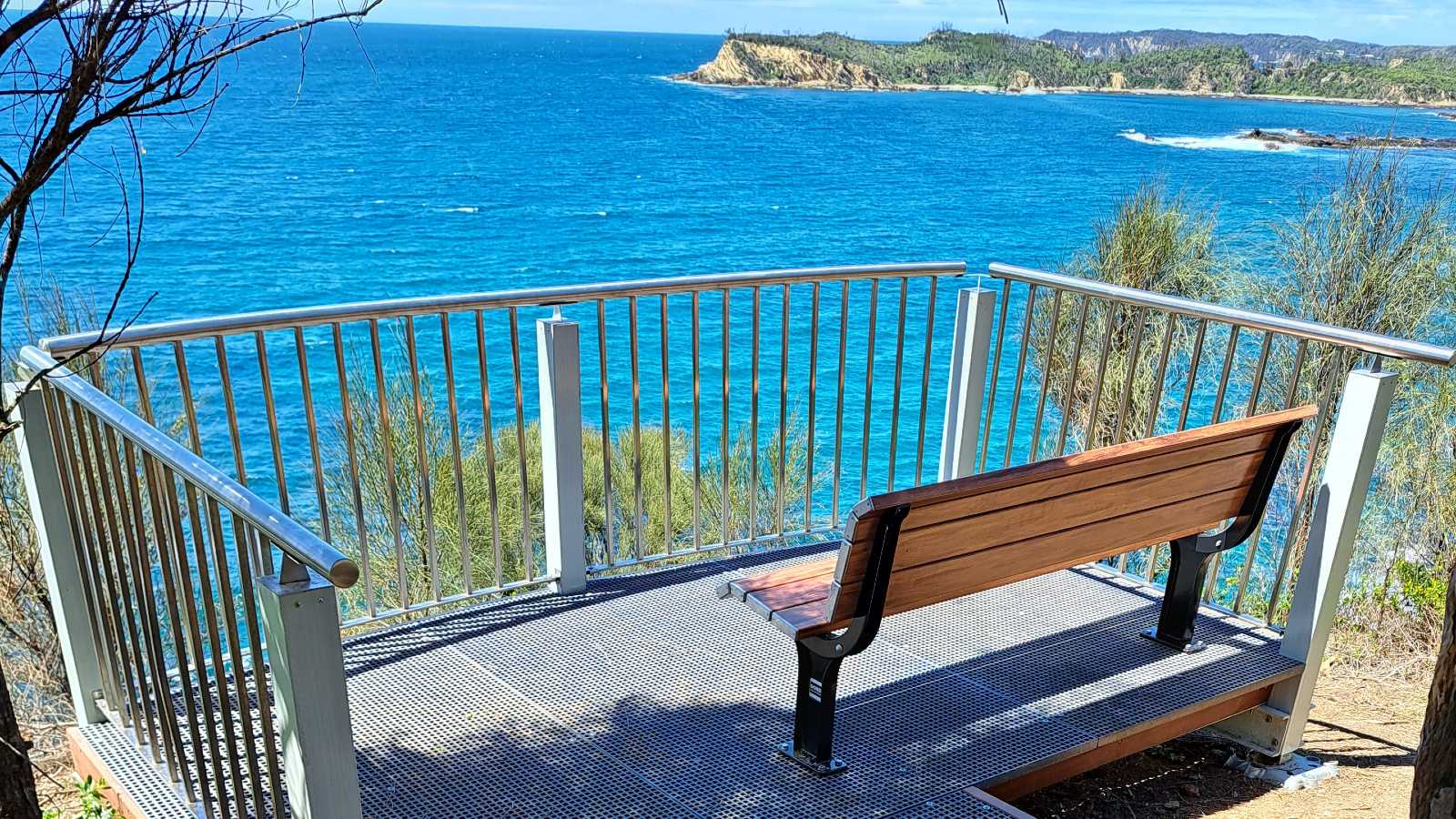
- Loads of people made the most of the awesome viewing deck at Observation Point and checked out the cool new features nearby.
- We invited locals to share their stories to help us create interpretative signs along the walk.
- By the end of the year, we had:
- finished installing the eight picnic tables, the ladder at Mosquito Bay, and most of the concrete pathways
- built approximately half of the raised walkways, steps, seats, viewing platforms, and safety barriers
- obtained approval from the grant authority to finish the project by December 2024.
2022
- December: Our crews worked on the Observation Point upgrade to get it ready in time for Christmas.
- November: Bushland management specialists started on sections of the trail to widen the track, trim vegetation, control weeds, plant native species and improve drainage to reduce erosion.
- August: We closed Observation Point to build the new car park, pathways, viewing areas, seats, shade structures, and yarning circle. Everything is on track to be open by the end of the year.
- June: We began work on the Observation Point upgrade by constructing the cantilevered viewing platform. It will take several months to build but will provide awesome views once complete.
2021
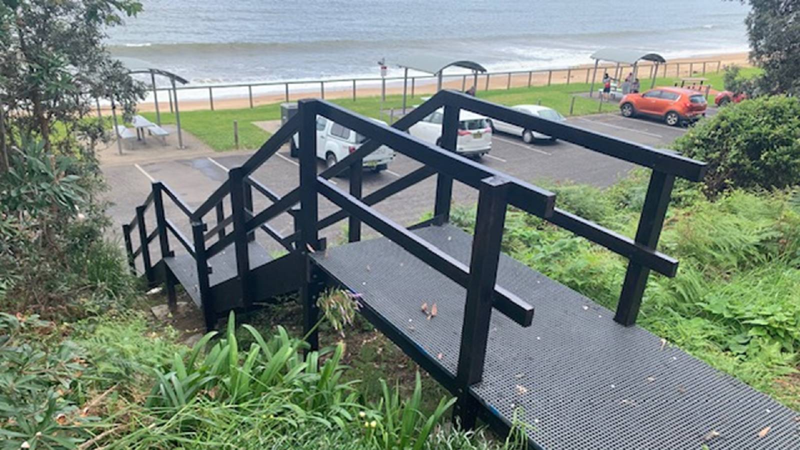
- December: Construction on the trail kicked off with a new staircase at the northern end of Caseys Beach in Batehaven. The old stone steps were replaced with a modern structure using mini mesh grating and hardwood handrails. The new steps provide safer access to the beach and will be maintained by Council.
- October: Council wrote to owners of land adjoining the trail to inform them of the project’s progression. Council staff will work directly with residents who might have encroachments like gardens or structures on the public land where the track passes. An online interactive map showing detail of the planned route was also made available.
- August: Council engaged the NSW Government’s Public Works Advisory to help with project planning and implementation.
- June: Our Natural Resource Management team is working closely with the Batemans Bay Local Aboriginal Land Council to identify and select culturally significant plants for the landscaping at Observation Point. They will also be working together to revegetate the natural areas surrounding the site in spring to reduce erosion and informal access points.
- May: Consultants Wolf Peak worked with the community to gather stories and develop design concepts for the Aboriginal and European cultural and historical information to be provided at Observation Point. They held a number of targeted meetings and community drop-in sessions to help them develop ideas. Public Works Advisory have been engaged to help with project planning for implementation of the coastal headlands walking trail.
2019-20
- Consultation undertaken during Hanging Rock, Corrigans Beach and Observation Point planning helped design the upgrade.
2010
- A concept plan for the Batemans Bay Coastal Headland Walking Trail was prepared:
- We acknowledge the 2010 document and appendices may not conform to accessibility requirements. Please contact us if a hard copy is required.
Downloads
- Coastal Headlands Walking Trail Community Engagement Plan (1.4 MB)
- Review of Environmental Factors - Observation Point infrastructure upgrade(2.0 MB)
Contact us
For more information, please contact Council:
- T: 02 4474 1000
- E: Council