Batemans Bay coastal protection works
Project: Protecting Eurobodalla’s northern beaches and low-lying areas from coastal erosion and inundation.
Timeframe: 2023 until 2027
Status: In progress
Cost and funding:
- $6 million, National Emergency Management Agency, Disaster Ready Fund, for Caseys Beach
- $5 million, NSW Department of Climate Change, Energy, the Environment and Water, to be shared between Long Beach, Surfside and North Batemans Bay
- $1 million, Council contribution
- Additional funds will be required for construction work.
Page last updated: November 2025
Project details
We are working to: investigate, design, and build long-term solutions at four priority sites:
- Bay Road, Long Beach
- McLeods Beach, Surfside
- Wharf Road, North Batemans Bay
- Caseys Beach, Batehaven
Benefits to the community:
- greater protection for community infrastructure
- continued access along roads during coastal storm conditions
- maintained access to beaches and private properties
- enhanced visual appeal.
Environmental impacts:
Prior to work starting at each site, a Review of Environmental Factors will be prepared to assess potential impacts related to the project's activities.
- Long Beach - Review of Environmental Factors (7.4 MB)
- Wharf Road - Review of Environmental Factors (7.4 MB)
- Surfside west - Review of Environmental Factors (7.8 MB)
Background and purpose
With rising sea levels and increasing severe weather events, much of our low-lying coastline is vulnerable to erosion and inundation. The Eurobodalla Open Coast Coastal Management Program (CMP) is our comprehensive guide for long-term coastline management.
The CMP details around 140 actions to mitigate the impacts of coastal hazards along 110 kilometres of coastline. Council is responsible for implementing these actions to protect community infrastructure. Private property owners can defend their own property and, just like Council, must obtain relevant approvals for protection works.
Council does not have the resources to deliver all the actions identified in the CMP. Therefore, we are focusing on high priority actions, starting with design and investigation work. Additional resources will likely be needed to build the coastal protection infrastructure, and we will continue to apply for grants as opportunities become available.
Each of our current priorities involves detailed investigations, environmental and heritage assessments, surveys and design work, cost-benefit analyses, planning, and community engagement. We also need various approvals from multiple NSW Government agencies. It’s time-consuming and complex work, with NSW Public Works Advisory assisting as the project management consultant.
Keep reading to learn about the priority areas, our plans, and the progress we've made so far.
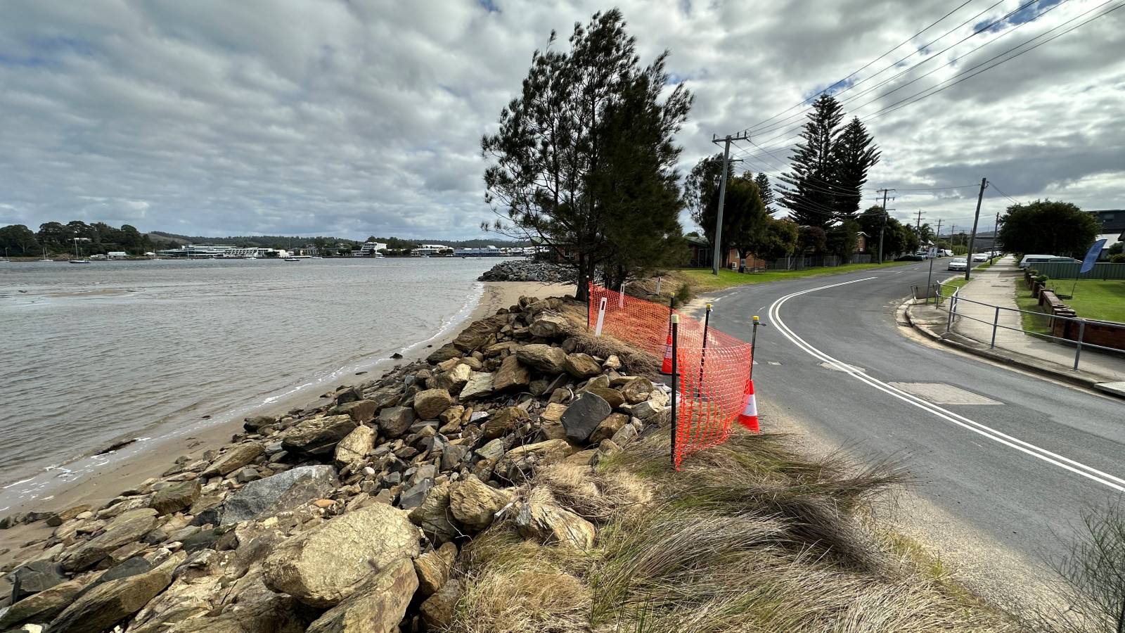
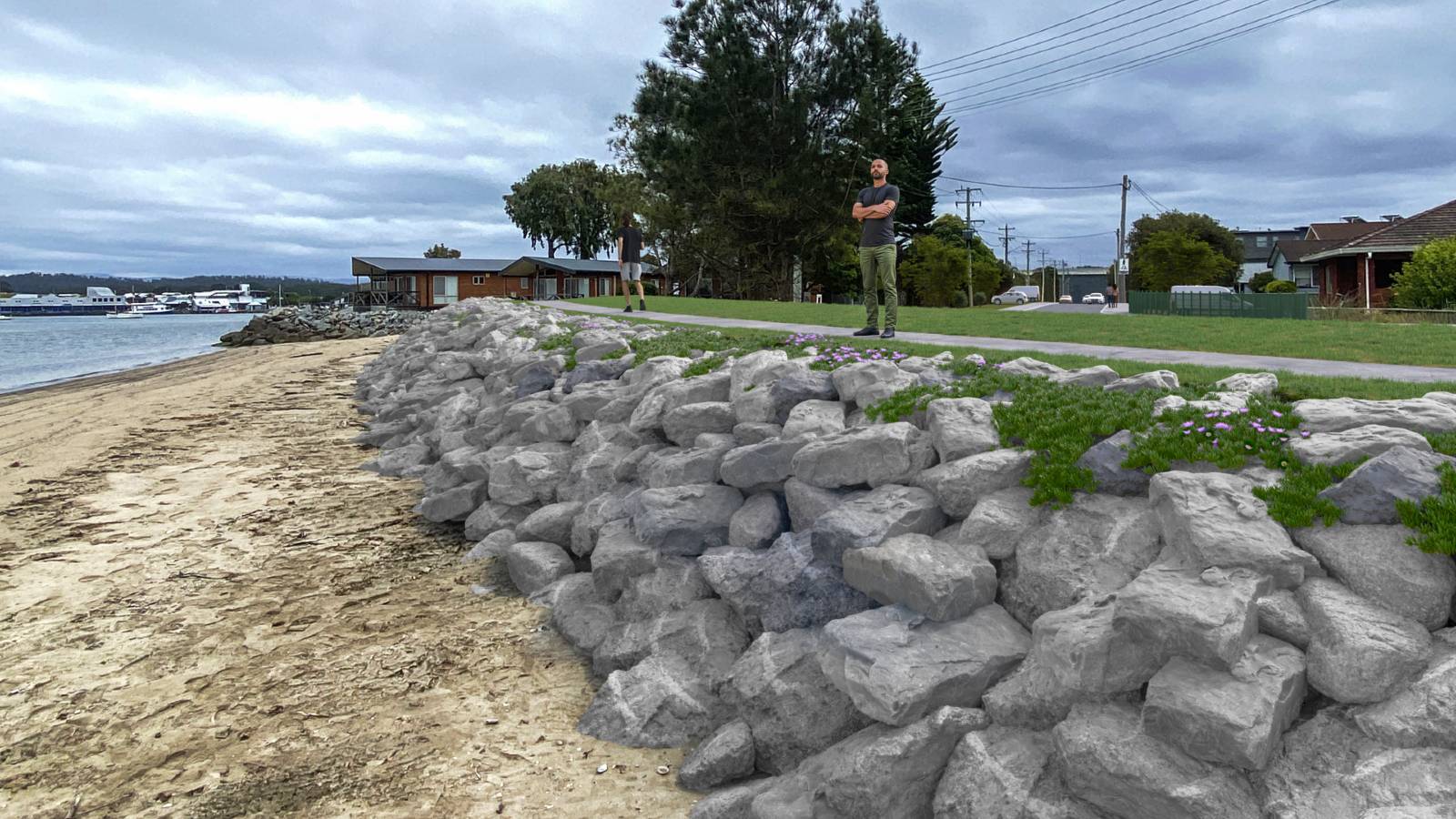
East coast lows have caused significant erosion of the Long Beach coastline, exposing the edge of Bay Road and leaving it vulnerable to collapse. The roots of large Norfolk pines have also been exposed.
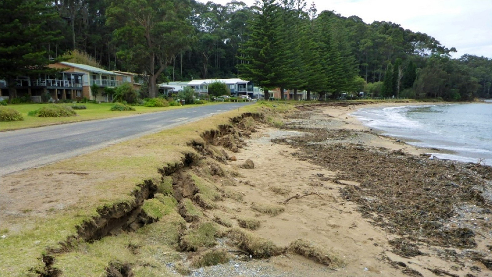
As Bay Road is critical for vehicle access to beachside properties, we have placed large geo-textile sandbags along the foreshore to provide temporary protection until a long-term solution is implemented.
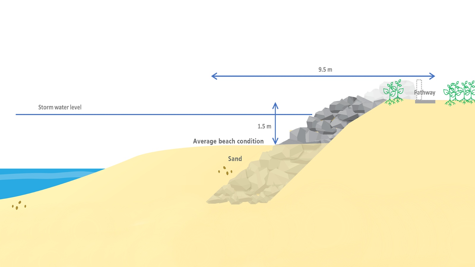
Protecting Bay Road is identified as a priority in the CMP, proposing a permanent structure such as a low-lying revetment along the foreshore. We engaged a consultant to design a sloped structure starting just after Fauna Avenue and continuing to just beyond the cul-de-sac.

In keeping with community feedback, our aim is to provide a structure that allows continued beach access, is low-lying and maintains the natural character of the foreshore and protects both the beach’s amenity and the road.
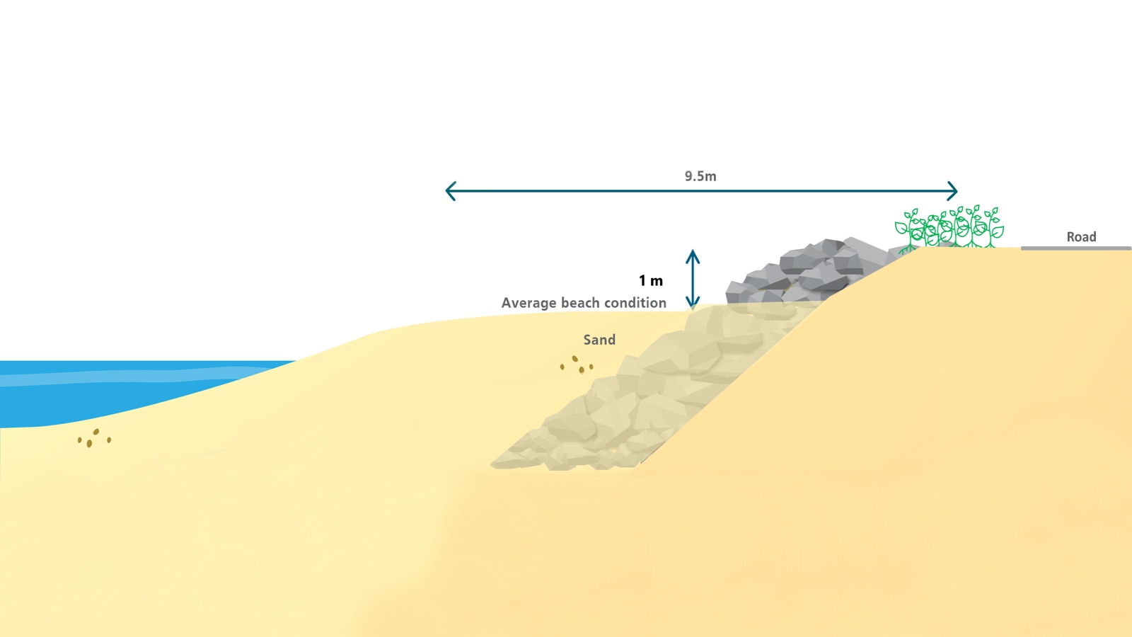
The design uses rocks averaging 1.12m in diameter, placed to a depth of 1.4m below mean sea level. The base of the structure will be buried under the sand. The top of the revetment will be 100mm above the road level (about 2.9m above mean sea level) and planted with coastal vegetation to support stabilisation and blend into the landscape. The middle layer of rock will remain mostly visible depending on the natural movement of sand.
A visualisation offers a clear representation of what the structure will look like once completed. It is expected to last up to 50 years.
Sign up for project updates
Updates
2025
- Work continued through September with about one third of the wall built and ready for the finishing touches on top.

- In August, we set up site and brought in materials and large machinery to start building the rock revetment.
- By mid-year, our consultant had completed the detailed design and the Review of Environmental Factors (REF) for the seawall construction. We started planning on-site works and applied for the final approvals.
- Geotechnical work around Bay Road was undertaken in February to gather important insights for designing effective coastal protection measures. This involved on-site investigations and assessments. Specialised machinery tested ground conditions and collected geological samples from various locations along the road and beach. The consultant will now use the data to refine the design of the proposed rock revetment.
2024
- Our consultant prepared plans for the sloped rock revetment. We invited the community to an information session on 10 December to see images and diagrams of the planned work.
- With information provided by the consultant, we decided the sloped rock revetment was the most suitable solution to provide protection.
- In July, we received some great input from the Long Beach community about how we can best manage coastal erosion in the long term. Our team started working with the consultant to review all the feedback and find the most suitable solution.
- In June, Worley Consulting developed three potential long-term solutions for managing the coastal erosion at Bay Road. We invited the community to a drop-in session at the Long Beach RFS shed to find out about each of the options and to provide feedback.
- In March, we awarded the tender to Worley Consulting to design the measures to protect the eastern end of Bay Road from severe coastal storm events.
2023
- In July, we created a geotextile sandbag structure to protect Bay Road and the foreshore until we can provide a long-term solution. To find out more about the emergency work visit Long Beach coastal erosion control
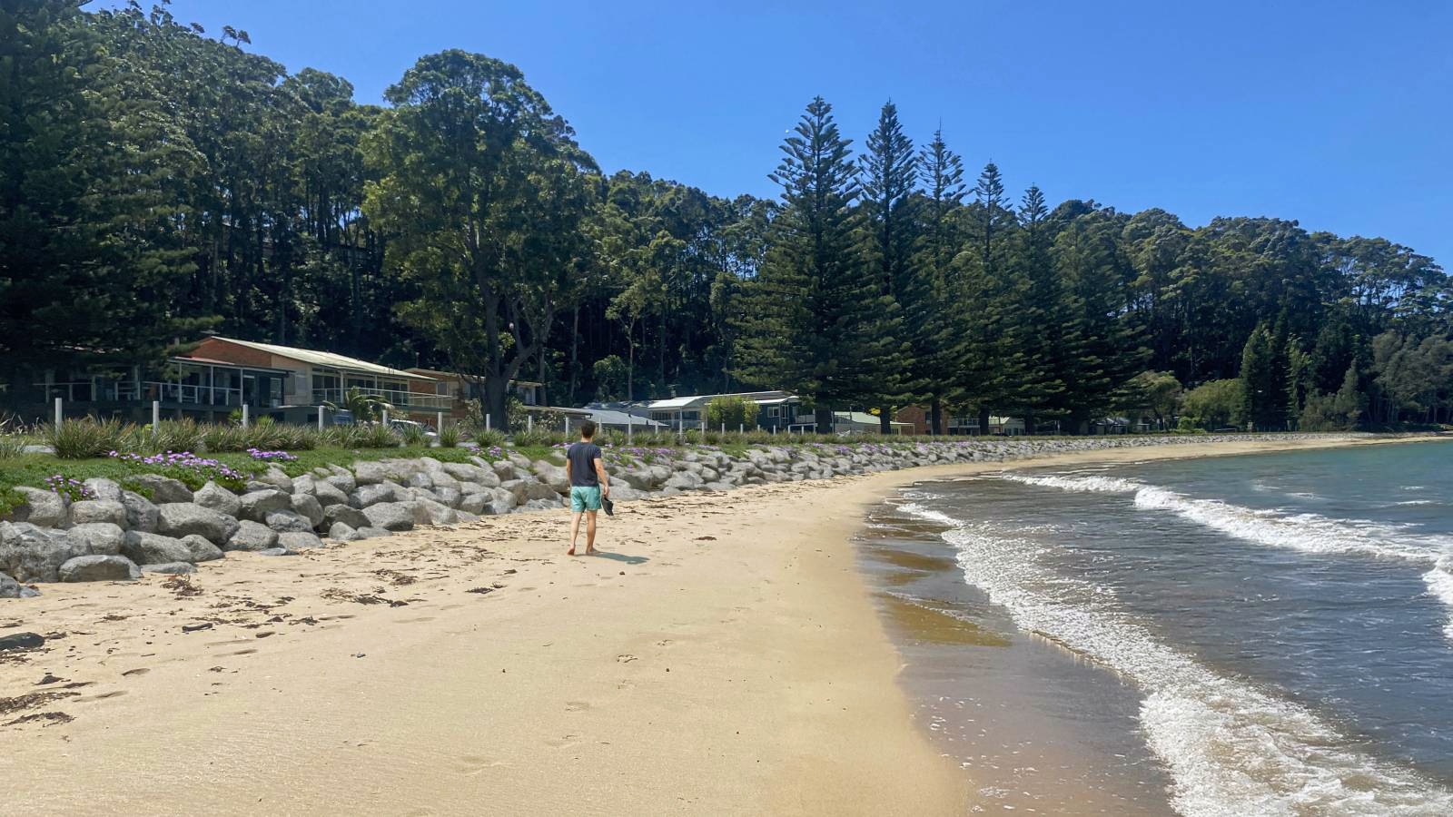
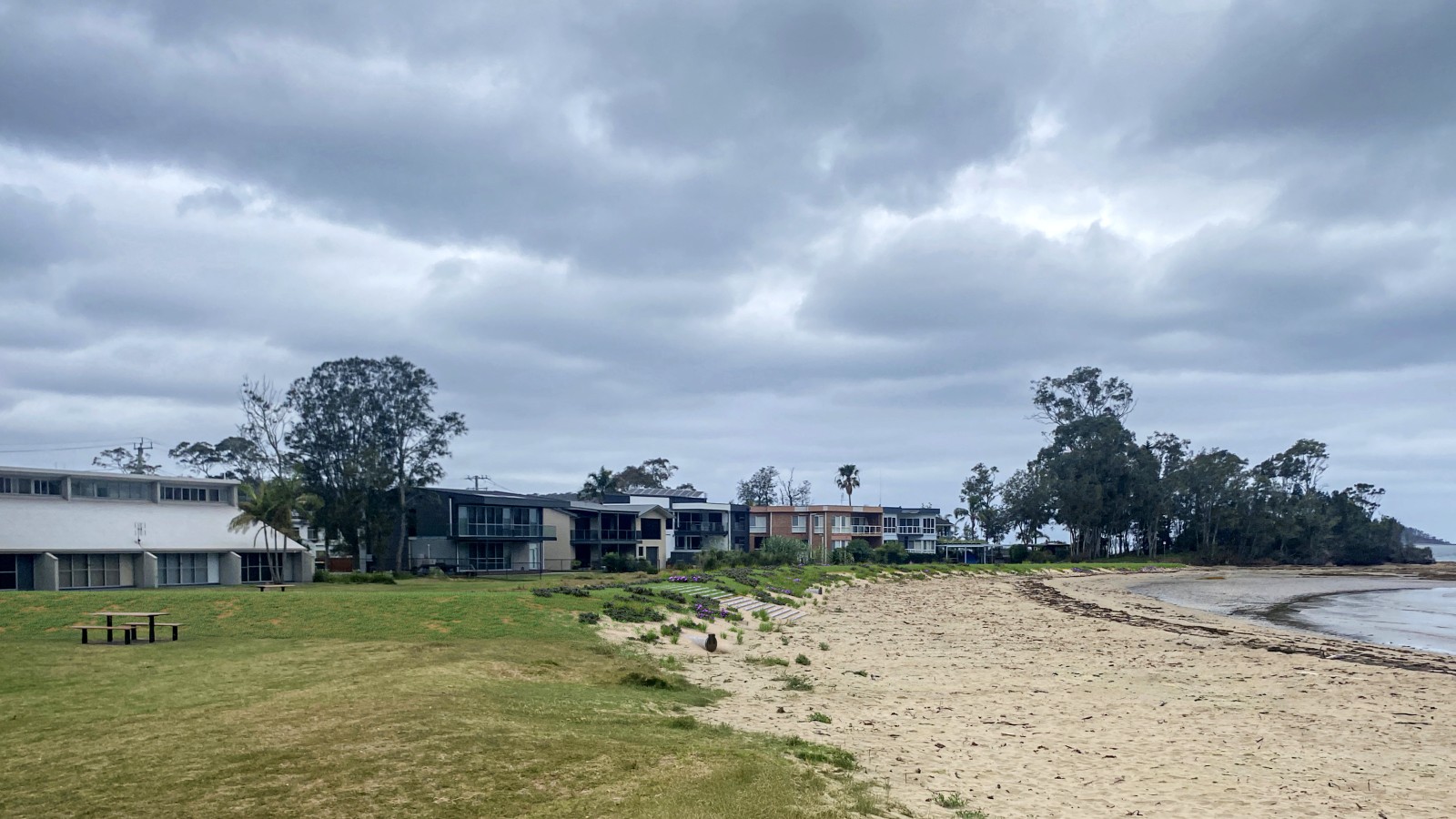
Due to the natural topography, the low-lying areas at the western end of Surfside, sometimes referred to as McLeods Beach or Dog Beach, are at risk of inundation during coastal storm events.
The CMP proposes the construction of a coastal inundation levee - a raised embankment - to reduce the volume of seawater reaching these low-lying areas during large coastal storms. We are working with consultants to investigate and design the most suitable option for this levee to protect public infrastructure and improve access along the beach.
The levee would extend from the trees at the eastern end of the beach along the foreshore behind 83 to 95 Timbara Crescent, and reach Wharf Road near the creek entrance. The western end of the proposed footprint extends further seaward than indicated in the CMP. This adjustment provides additional protection to the public reserve and integrates with existing infrastructure at the creek entrance. As noted in the CMP, the levee will be designed with the capacity to increase its height and length to accommodate rising sea levels.

Our consultant has designed the levee using rocks with an average diameter of 0.51m. These rocks will be carefully placed, buried to a depth of 0.3m, and will rise to 2.5m above mean sea level. The levee will extend approximately 0.5m above the reserve ground level, covered with 100 mm of top fill, and finished with grass or other primary vegetation.
The design allows for an increase in height to reach 3.3m above mean sea level in a second stage of the project.
A visualisation offers a representation of what the levee will look like once completed. It is expected to last up to 50 years.
The CMP also identifies beach nourishment using sand from the Clyde River to replenish certain beaches. Transport for NSW are responsible for this work, and we advocated to get this underway at the northern end of Surfside Beach as a matter of urgency. For more information about the dredging work affecting Surfside east visit Transport for NSW - Batemans Bay Dredging
Updates
2025
- Detailed design work for the proposed levee continued into the middle of the year and is dependent on updated modelling from an overland flood study. This modelling is essential to inform the design and complete the Review of Environmental Factors (REF).
- Geotechnical work was undertaken in February around McLeods Beach to gather important insights for designing effective coastal protection measures. This involved on-site investigations and assessments. Specialised machinery tested ground conditions and collected geological samples from various locations in the reserve and along the beach. The consultant will now use the data to refine the design of the proposed levee.
2024
- Our consultant prepared plans for the coastal inundation levee. We invited the community to an information session on 10 December at the Long Beach RFS shed to see images and diagrams of the planned work.
- In March, we awarded the tender for designing coastal erosion protection works at Surfside to Worley Consulting. The design includes a levee to safeguard the western end of Surfside beach against coastal erosion and inundation.
2023
- In December, we met with interested members of the community to talk about the conditions at Surfside Beach. We discussed the challenges brought on by coastal erosion and shared information about our plans for the area.
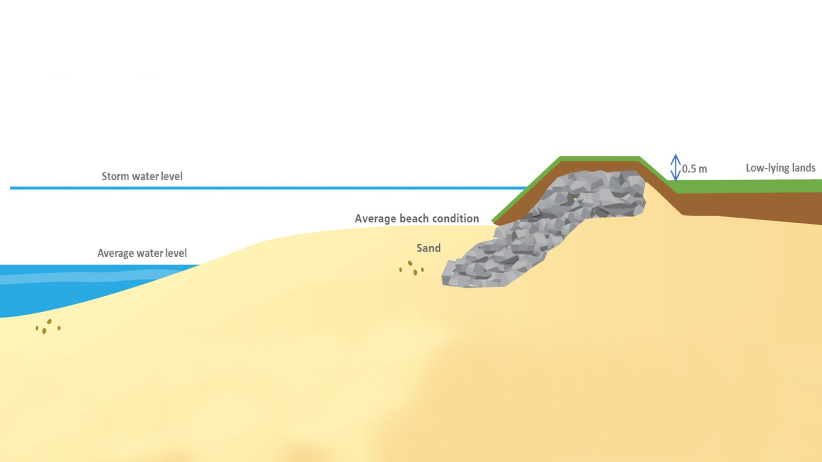
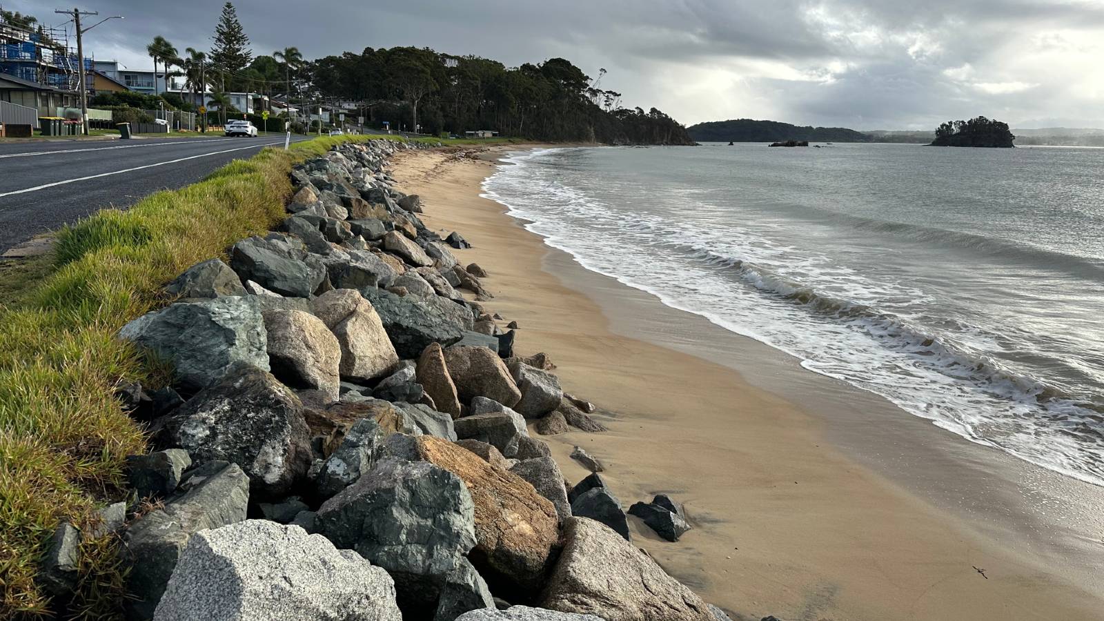
The sharp corner on Wharf Road in North Batemans Bay is at risk of collapsing due to the encroaching shoreline, threatening access to the area.
The CMP recommends implementing structural protection, such as a seawall. This structure would effectively reduce the chances of wave damage to the road, ensuring its continued accessibility even during coastal storm conditions.
Working with consultants, we are investigating and designing a seawall that would follow the bend of Wharf Road and connect to the seawall currently protecting Easts Riverside Holiday Park. The 100m-long structure would follow the shape of Wharf Road, extending further seaward than the current structure at the tight bend. The proposed location for the revetment has been moved further seaward compared to the alignment shown in the CMP. This adjustment is to provide increased protection for the road, underground services and surrounding areas.

Our consultants have designed a seawall using rocks with an average diameter of 0.54m. These rocks will be carefully placed, partially buried to a depth of 1m below mean sea level. The crest of the wall will be 2.5m above mean sea level, which is about 0.5m above the road level.
After storms, more of the structure may become exposed, but the sand should return within a few months. The design also includes a concrete footing that will act as a path for community access.
A visualisation offers a representation of what the structure will look like once completed. It is expected to last up to 50 years.
The proposed structure would protect Wharf Road and surrounding low-lying areas and allow safer public access to the beach. The design allows for future extension to a height of 3.5m, and the addition of a concrete wall for further protection. The wall would tie in with our plan to raise the height of the road as part of future upgrade work. Additionally, we plan to rehabilitate the beach areas to enhance amenity.
The proposed alignment and design are subject to land acquisition and further approvals.
Updates
2025
- By mid-year, the consultants had completed both the detailed design and the Review of Environmental Factors (REF) for the seawall construction. Council and relevant NSW Government agencies are now reviewing the documentation. At the same time, the NSW Office of Strategic Lands is working to acquire the land needed to carry out the works.
- Geotechnical work was undertaken in February around Wharf Road to gather important insights for designing effective coastal protection measures. This involved on-site investigations and assessments. Specialised machinery tested ground conditions and collected geological samples from various locations along the road and beach. The consultant will now use the data to refine the design of the proposed seawall.
2024
- Our consultant prepared plans for the proposed seawall, which depend on the land being acquired first. We invited the community to an information session on 10 December at the Long Beach RFS shed to see images and diagrams of the proposed work.
- In March, we awarded the tender for designing the North Batemans Bay coastal erosion protection works to Worley Consulting. The design includes developing measures to safeguard Wharf Road corner against coastal erosion and inundation.
The existing seawall at Caseys Beach no longer provides adequate protection for Beach Road against coastal forces. During high seas, waves can overtop the seawall, causing damage to the road and surrounding areas.
The CMP recommends replacing the seawall and installing a wave return barrier at the top. The proposed replacement structure will likely feature a similar sloped formation but will be taller, wider, and constructed with larger rocks for enhanced durability. The top barrier is expected to be a low concrete wall, prioritised for installation near the large culvert at the southern end of the beach, where the risk is greatest. Additional sections will be completed as funding permits.
The new, more robust seawall will be engineered to withstand extreme coastal conditions and designed with flexibility for future modifications. This approach will help maintain safe access along Beach Road as sea levels continue to rise.
Updates
2025
- Consultants are currently developing the detailed design, Review of Environmental Factors (REF), and other necessary assessments for the new seawall. Once these assessments are complete, we’ll be in a stronger position to determine the likely timing and scope of construction.
2024
- In July, we awarded the tender for designing the Caseys Beach Coastal Erosion Protection Seawall to Bluecoast Consulting Engineers. The design includes developing measures to safeguard Beach Road against coastal erosion and inundation
More information
For more information, please contact our Senior Project Manager - Major Projects, Paul Pomfret:
- T: 02 4474 1391
- E: Council