Restoring access - Araluen Road
Project: restoring safe access along Araluen Road after bushfires and flooding.
TImeframe: January 2020 to October 2023
Status: Complete
Funding: NSW and Australian governments' Natural Disaster Relief and Recovery Arrangements
Page last updated: October 2024
Details
Araluen Road begins on the outskirts of Moruya, loosely follows the Deua River through mountainous forest and leads to Araluen and then Braidwood. The narrow, mostly unsealed road is the main access route for properties in the Deua River Valley and Merricumbene.
The 2019/2020 summer bushfires and nine natural disaster floods and storms that followed caused damage on an unprecedented scale and significantly affected the Araluen Road community.
Along with personal, property and environmental impacts, residents also had to deal with access issues caused by damage to the Council-maintained road network. Bridges were destroyed, the road surface suffered, fire-affected roadside trees presented a danger, and multiple roadside slopes collapsed.
Council dedicated significant resources to and has received funding through the NSW and Australian governments' Natural Disaster Relief and Recovery Arrangements.
The challenges were many, however, we focused on restoring safe access with the aim to provide improved resilience into the future.
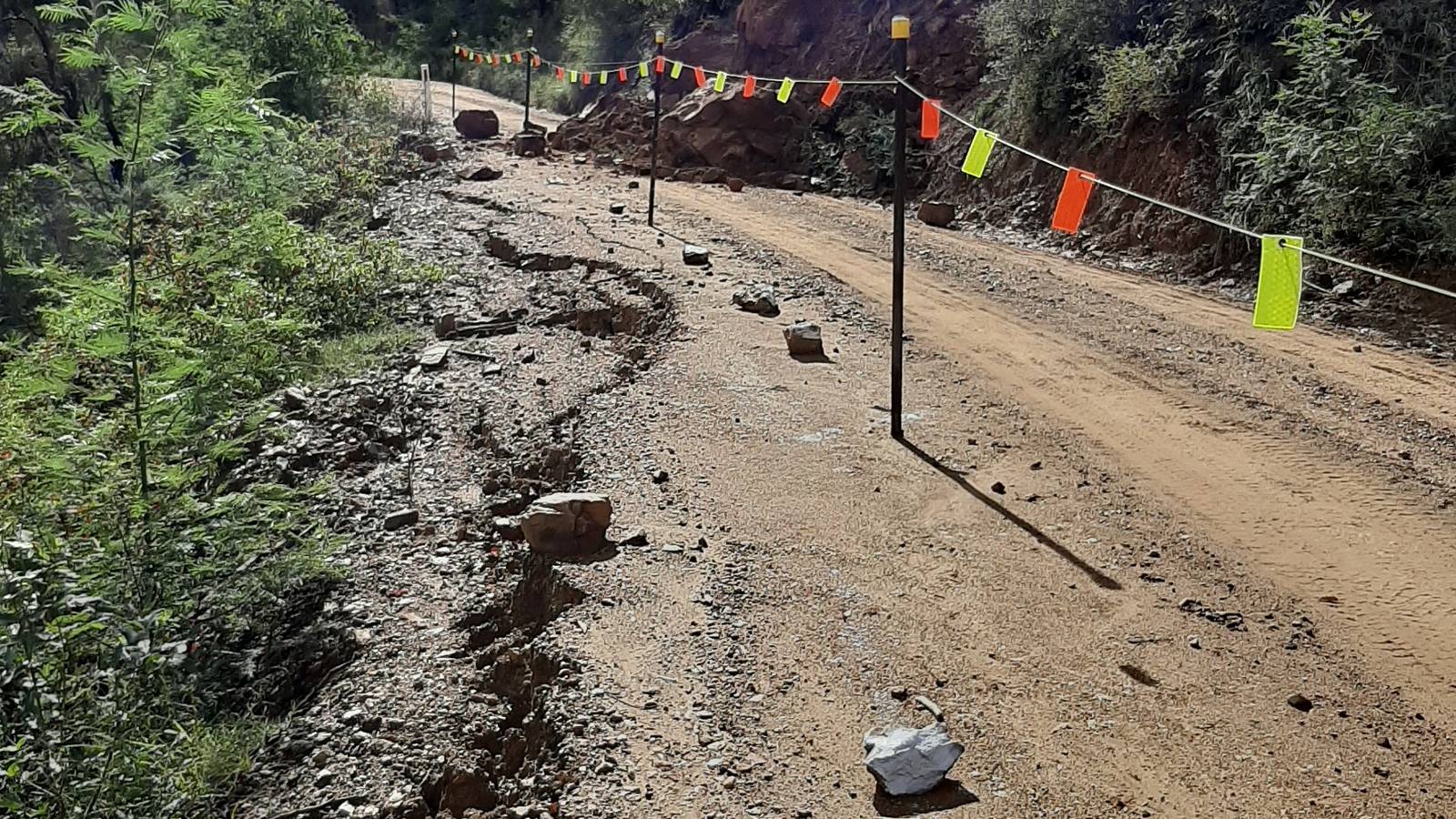
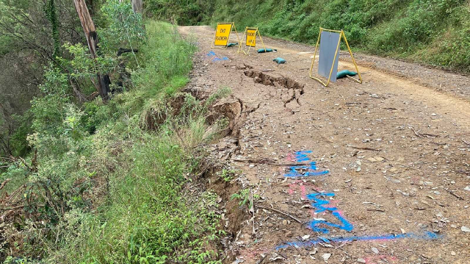
Drought then bushfire and high rainfall has caused serious damage to the roadside slopes along Araluen Road. There is extensive tension cracking and slope movement on the upper and lower slopes in many areas.
The locations of the landslides and tension cracking are within mountainous riverside terrain with very steep up and downhill slopes. Instability on both the high and low sides of the road means we cannot simply clear the road of the debris.
We identified numerous sites requiring treatment as a result of the natural disasters. While we have cleared many, others require more specialist extensive investigation.
11km and 14km from Moruya
Work to restore the road at the smaller landslips at the 11km and 14km marks is underway with excavation on the high sides of the road complete, providing a wider road and allowing safer and more efficient stabilisation works of the downhill embankments. The excavated material has been repurposed and placed along the road closer to Moruya (near the water pump station) to widen the road shoulders and improve safety.
Stabilisation works on the downhill slopes at these sites was undertaken in 2022. The completed works is providing more stable road platforms and greater road width, making it safer for vehicles to pass.
18-19km from Moruya
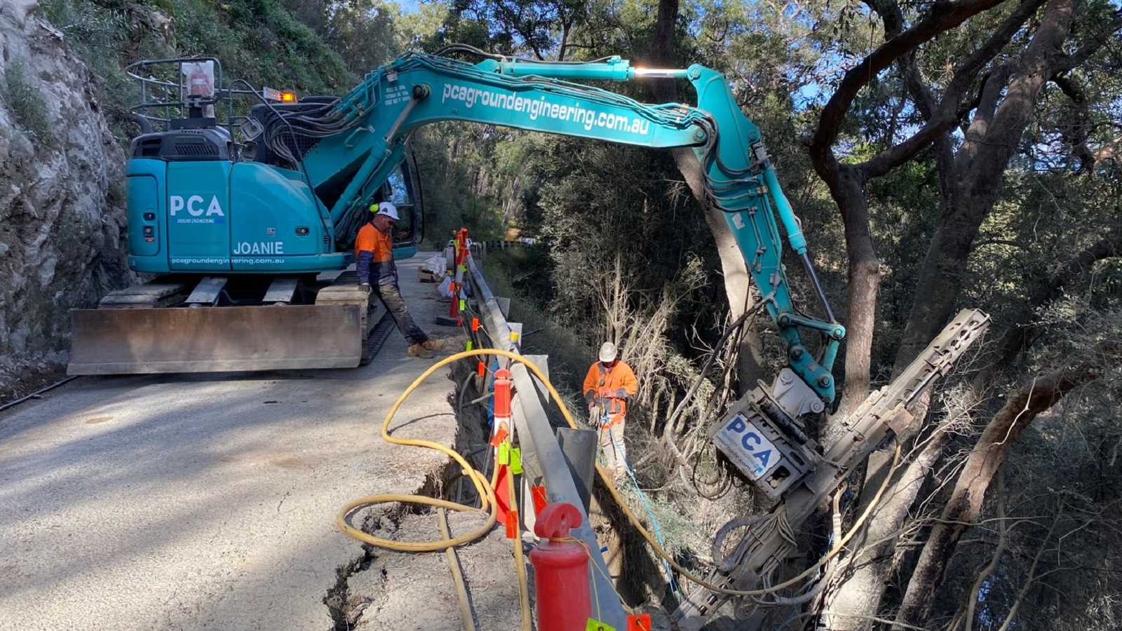
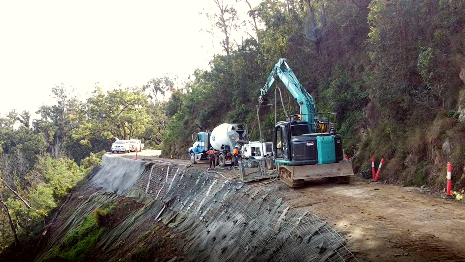
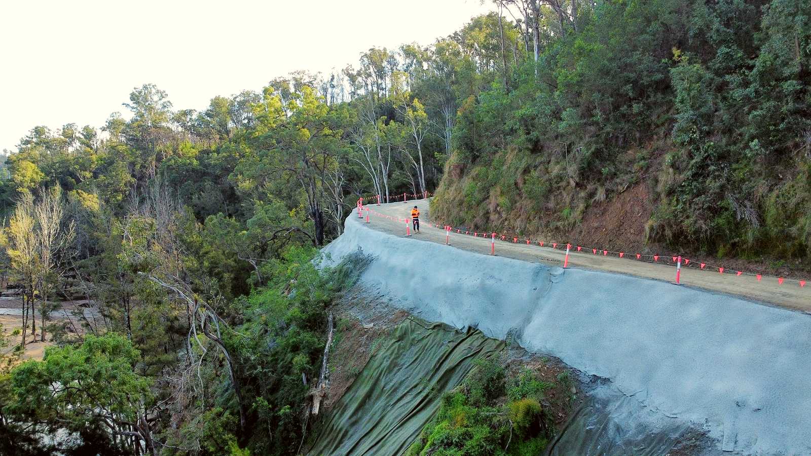
High rainfall during the February/March 2022 flood caused significant failures along the road around 18 to 19km from Moruya. The downhill roadside slopes were giving way and were at risk of further collapse.

Work was undertaken to recover sections of the road, using heavy machinery to drill soil nails beneath the road and cover the slope with shot-crete.
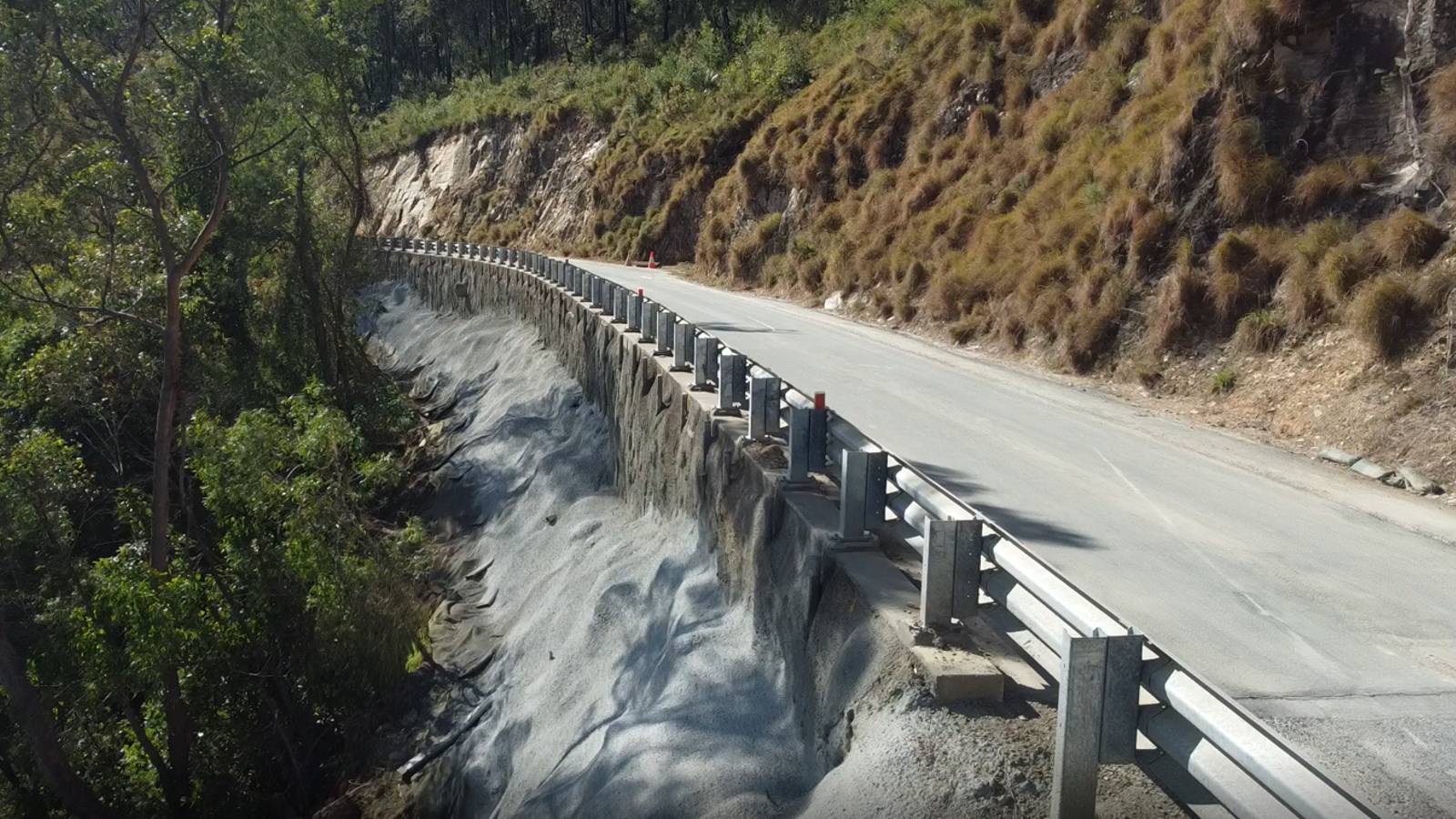
Contractors applied concrete to the downhill slope of the foam block wall where the road was recovered a few years back.
19km from Moruya
This landslide is located on a particularly narrow section of road where the low side of the road is collapsing. If this section of roadway were to suffer further damage, access beyond this point would become problematic. Therefore, this location was given priority.
Contractors have undertaken roadside stabilisation works to reduce the risk of further collapse. The completed works are providing a safer, more resilient road.
Work involved drilling soil nails on the low side of the road to secure the slopes.
The collapsing roadside had left the guardrail hanging alongside the road.
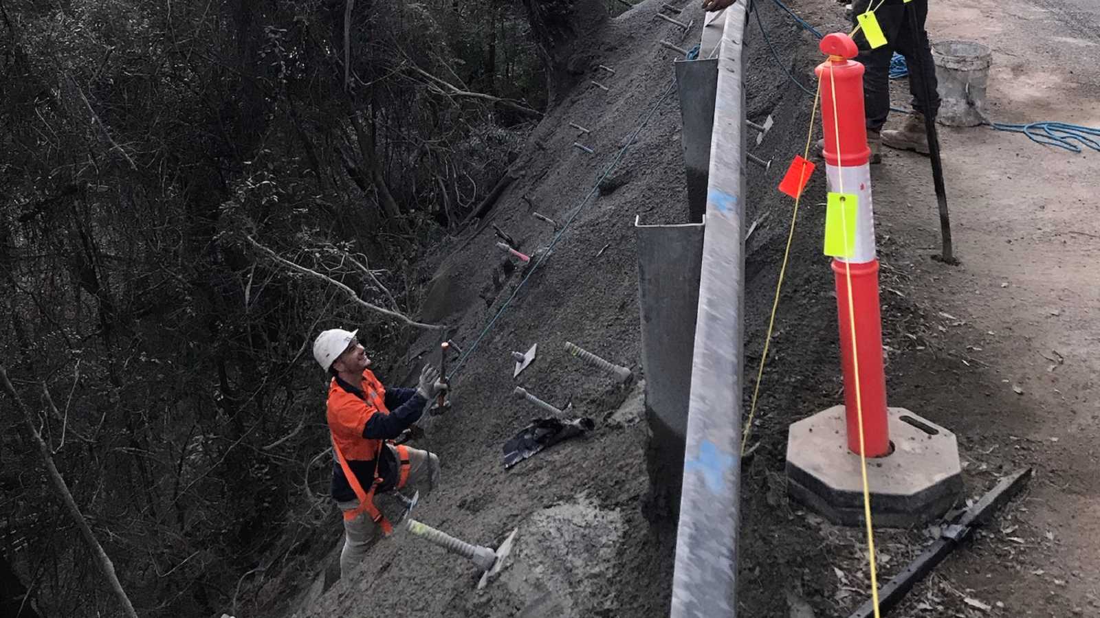
Concreting of the batter face has helped to stabilise the roadside slope.
Other works for this site include:
- removing trees to make the roadway and worksite safe
- earthworks to widen the road on the cut side
- restoring the road surface and protective fencing (which became suspended due to the ground below having slipped away).
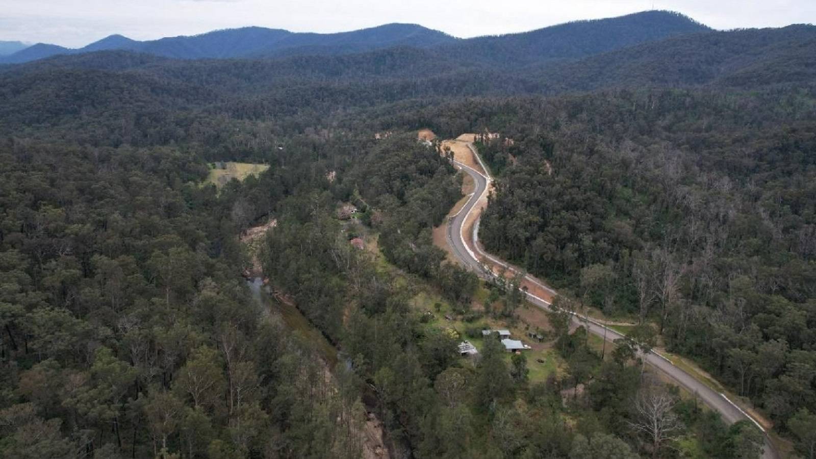
22km from Moruya, east of Knowles Creek
A large landslide in November 2020 resulted in a complete blockage of the road. Further material came down during the March 2021 floods and other landslides have since occurred nearby.
This major landslide site presented significant challenges due to the unstable rock face and further movement along this stretch of road. Simply clearing the road was not an option as the risk of further landslides is unacceptably high.
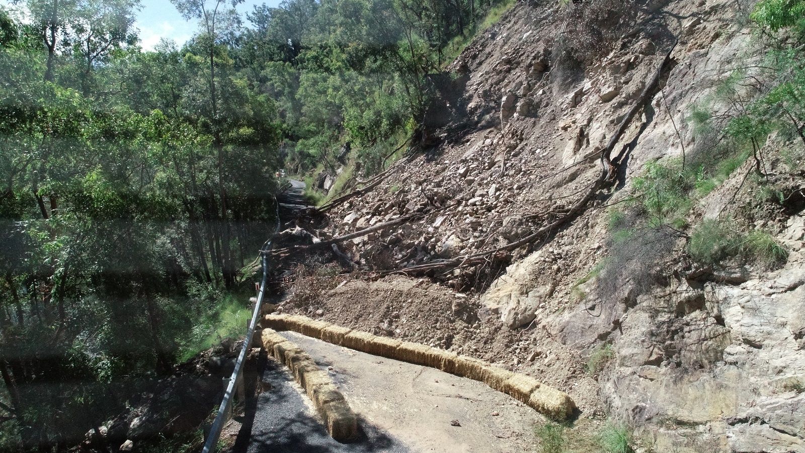
Geotechnical coring immediately above and behind the landslide showed highly fractured and unstable materials that would prove difficult to stabilise sufficiently to ensure recovery of a safe route along the existing Araluen Road.
We successfully negotiated an agreement and funding to construct an alternate route around the landslide rather than repairing the existing road. The NSW and Australian governments provided $3 million through the Natural Disaster Relief and Recovery Arrangements allowing us to create a safer and more resilient solution for the community for the future.
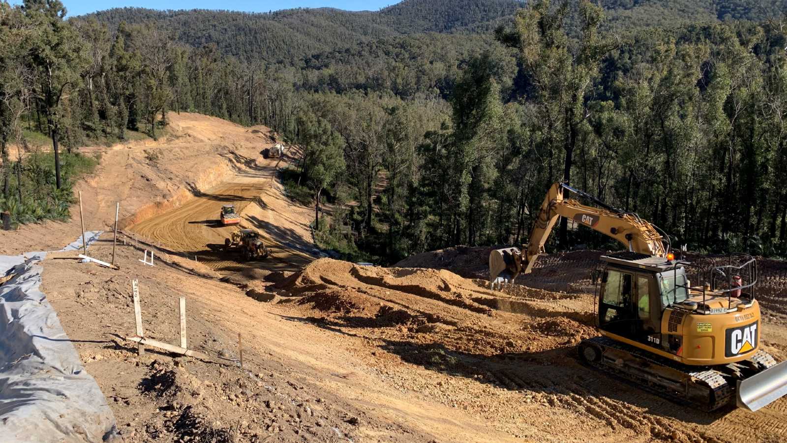
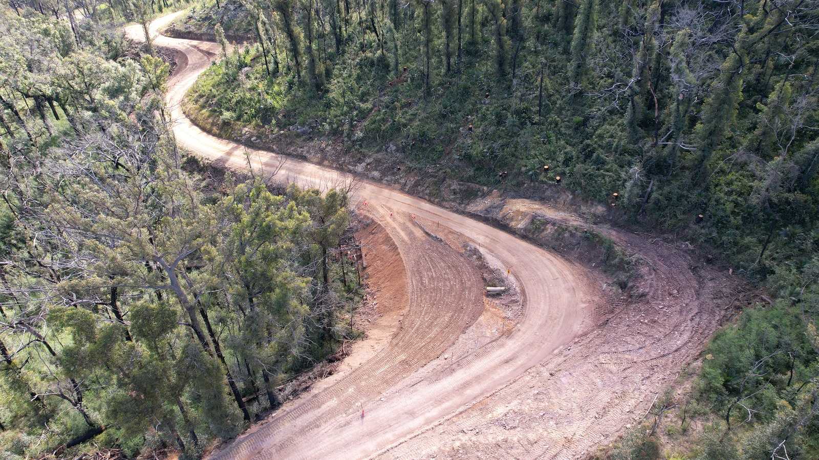
Work began on the construction of the new road on 5 July 2021.
A dozer and scraper prepared the new road. Pipe crossings and catchment drains were installed to provide suitable drainage.
As work progressed so did our remediation of the area; the old road was covered in topsoil and spray seeded with a native grass mix in time for the favourable spring weather.
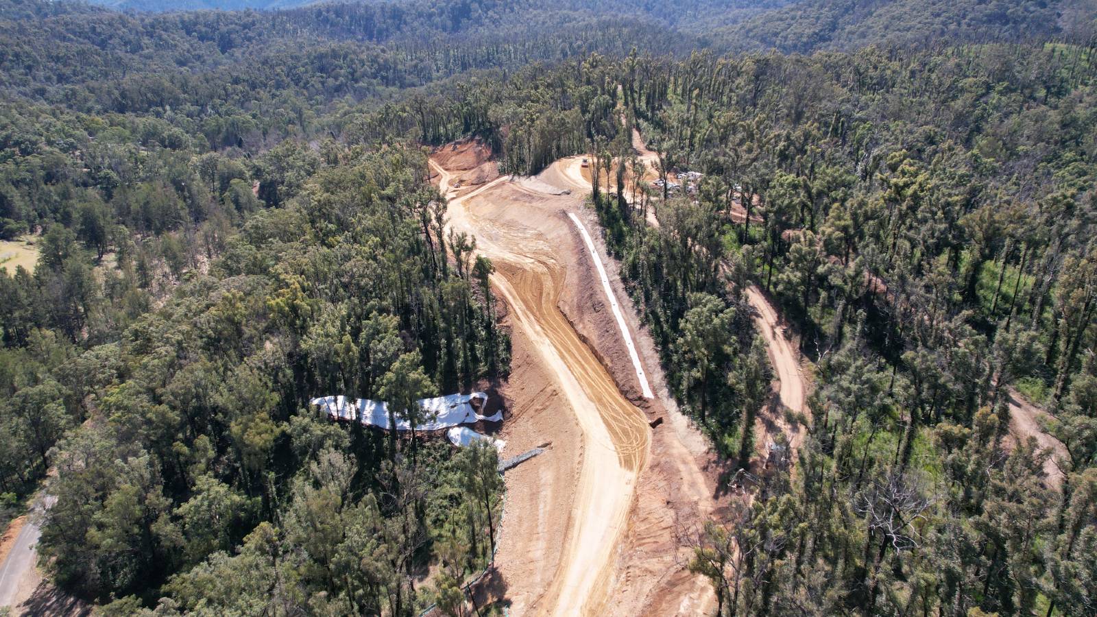
A detour route was established for Araluen residents while construction of the new road was underway. Unfortunately the detour route was destroyed during a flood in December 2021. The new section of road was opened to essential traffic only to ensure residents could still access their properties.
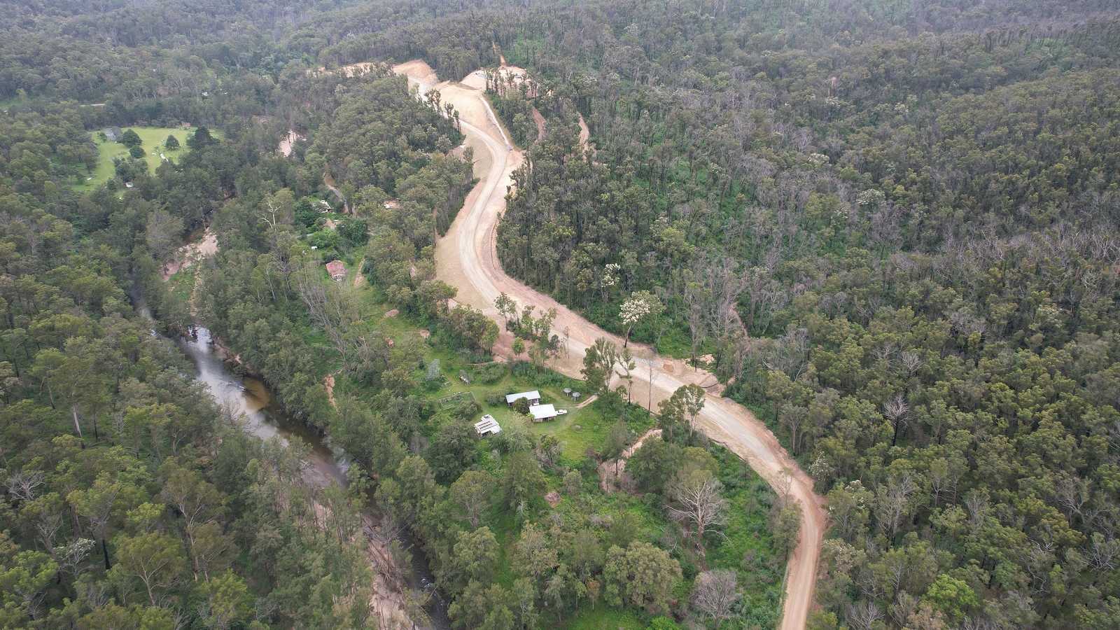
Work continues along this new section but it is now open to the wider community, re-establishing access along Araluen Road from Moruya to the major landslide east of Pigeon Gully.
The section of road has now been sealed.
24km from Moruya
High rainfall during the February/March 2022 flood caused significant failures along the road 24km from Moruya. The downhill roadside slopes were falling and at risk of further collapse. Work was undertaken to recover sections of the road, using heavy machinery to drill soil nails beneath the road.
26km to 31km from Moruya
We are preparing to work at three sites just north of the RFS shed. The downhill slopes are giving way and require slope stabilisation treatment. We have engaged geotechnical specialists to undertake investigative work to determine the requirements for slope stabilisation at each site.
Both the preliminary work and the repair work will require full road closures to be in place due to the large machinery needed for the job. Stay up to date with current and upcoming road closures via Live Traffic NSW.
41km from Moruya
Specialist contractors have undertaken extensive stabilisation works at Goodenough Gully. The road was closed during works due to the size of the machiney working on the narrow road.
We will continue with other works in this area to:
- improve pavement and drainage
- undertake additional earthworks to improve the resilience of the road.
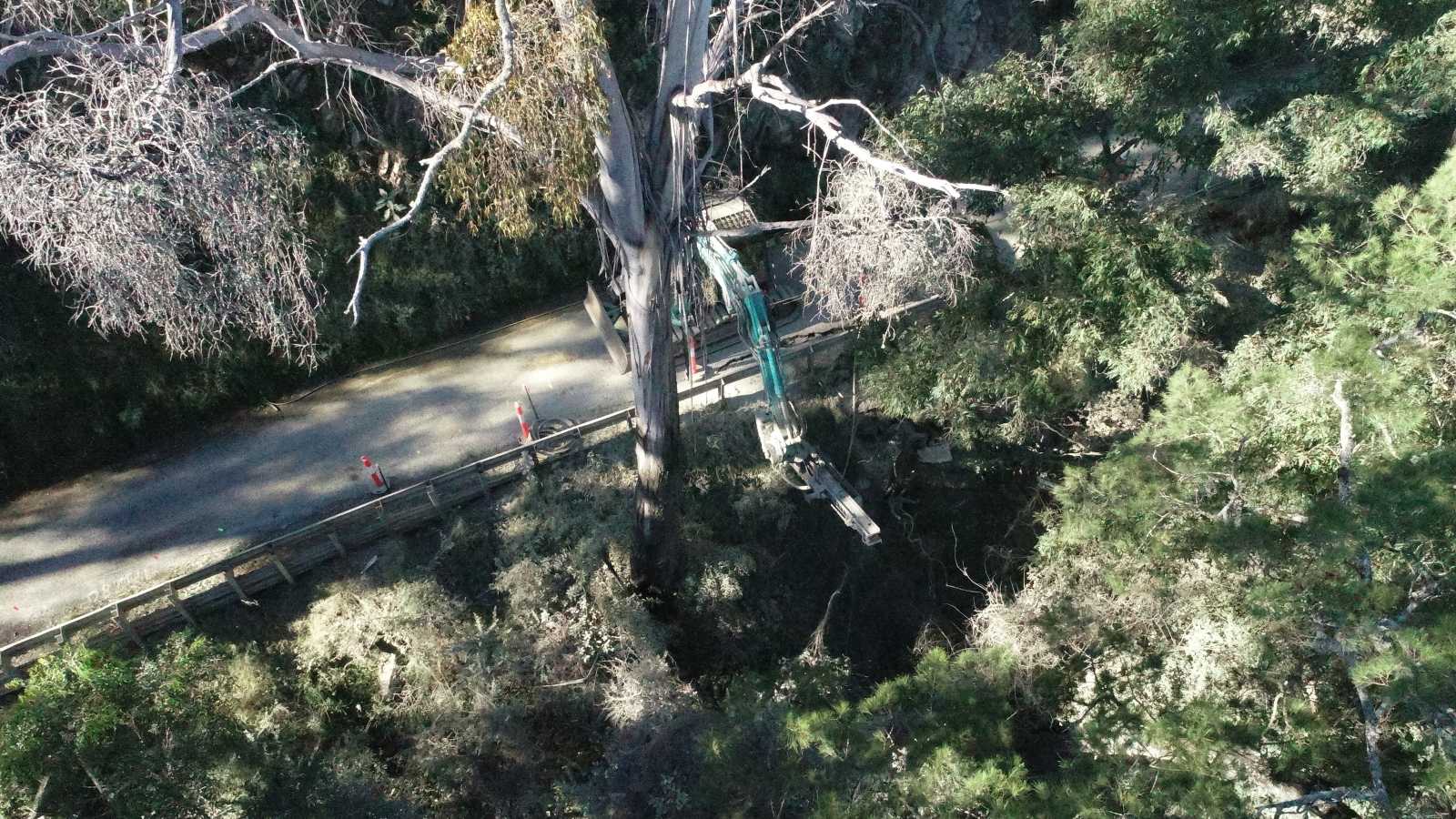
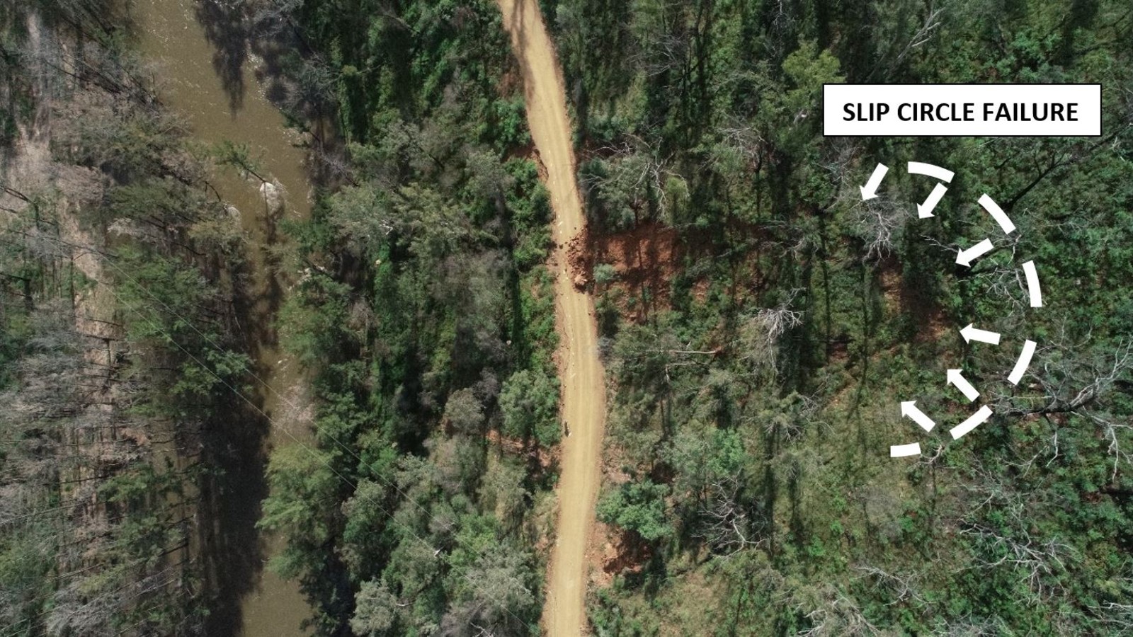
43km from Moruya, near Pigeon Gully
The landslide at this site was very complex, with extensive longitudinal failures and steep mountainous slopes on both sides of the road. Longitudinal cracking on the low side meant the road was collapsing over a length of several hundred metres, dropping steeply toward the Deua River.
Since the upslope landslide occurred during the May 2021 flood, access along Araluen Road west of this location was only available from Braidwood. Access to Araluen Road east of this landslide was only available from Moruya.
Drone footage at this site shows the landslide was much more significant than first thought. A large slip circle failure developed well above the road, with a huge volume of material having moved partially down the hill. The drone pictures also confirmed the extensive tree death at this location, which was problematic in terms of sequencing any recovery works.
The challenges of this site required a careful and systematic approach, backed by specialist advice, to ensure the safety of workers on-site. NSW Public Works Advisory (PWA) investigated the options to restore safe access. In September 2021 PWA engaged a suitable consultant to undertake the geotechnical and design investigations.
Investigations found that the option of building a public road around the landslide was not viable due to various issues including high cost and land tenure. After making a commitment to recover the existing road, we completed detailed geotechnical investigation and design works and called for tenders.
At the Council meeting on 23 August 2022, Council approved Specialised Geo to undertake the clean-up, recovery and stabilisation work.
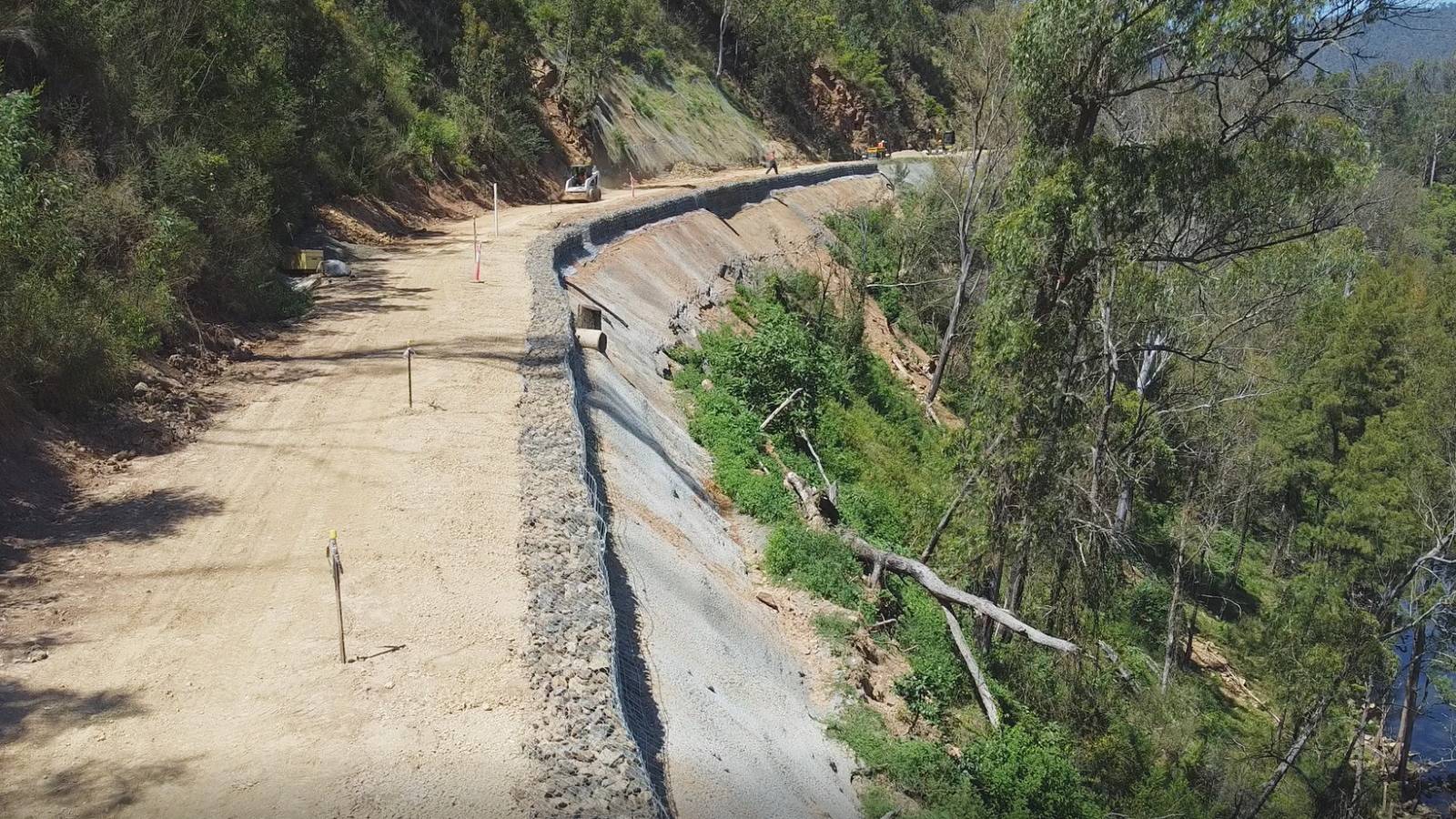
Work involved:
- stabilisation and building a 250m long retaining wall on the downhill slope
- rock bolting and installing tensioned mesh on the uphill slope
- reconstructing and sealing the road
- installing guardrail.
This work started in mid-October 2022. In May 2023 the road was open to traffic.
45km form Moruya, Merricumbene
High rainfall also caused significant failures along the road at Merricumbene. The downhill slopes of the road were collapsing and work was urgently undertaken to recover the road.
Contractors used heavy vehicles and machinery to drill in the soil nails and coat the downhill slopes with shot-crete. The narrow width of the road left little room for commuters so the road was closed to get the work done.
Soil nails and shot-creting have stabilised the roadside slopes.
Beyond the Eurobodalla Shire border
Queanbeyan-Palerang Regional Council (QPRC) has undertaken stabilisation works on Araluen Road:
You can find out about the QPRC work and any road access restrictions via:
- T: 1300 735 025
- W: Araluen Road flood damage repairs
Four timber bridges along Araluen Road have been damaged or destroyed by recent natural disasters. The NSW and Australian Governments have provided financial assistance through the National Disaster Recovery and Relief Arrangements to restore safe access.
- Bradbuys Bridge was damaged beyond repair during winter 2020 floods. Barriers and a reduced speed limit helped keep the road open until the bridge was replaced in early 2021.
- Pigeon Gully Bridge was rebuilt in the first half of 2020 using concrete box culverts after it was destroyed during the Black Summer fires.
- The fires also damaged McGregors Creek Bridge and Kennys Creek Bridge. Temporary structural repairs were quickly undertaken to keep the road open until the bridges could be replaced. The rebuilds were scheduled for late 2020 but were set back by access problems caused by the landslides. Work on the road realignment at Knowles Creek in 2021 enabled contractors to transport heavy equipment to the bridge sites. We have since replaced the two bridges using the InQuik Bridging System.
- To follow the story of replacing the bridges visit Restoring access – Northern bridges
To further assist with access to Araluen Road properties we replaced Codys Bridge on Larrys Mountain Road by providing an alternative route in the event of an emergency.
By rebuilding more resilient structures our roads are more likely to withstand future flood and fire events.
Immediately after the fires our crews inspected and removed hazardous burnt and fallen trees to re-open Araluen Road and reduce the risk to road users.
While regrowth on other trees was initially encouraging, the stress of the prior drought coupled with bushfire resulted in a secondary wave of tree death.
Specialist tree arborists assessments were required to determine which trees need to be removed to keep commuters safe. We engaged a tree crew to selectively remove the dangerous trees. The majority of work is now complete however we will continue to monitor the roadside trees and undertake further works as necessary.
Also of concern is the extensive emergence of wattle seedlings along the roadsides, creating a dense thicket. We have undertaken roadside spraying in key locations to reduce wattle growth and increase line of site for road users. We plan to spray the roadsides of the full length of Araluen Road.
Our teams are working to deal with both of these issues in a way that leaves our roadsides safer for road users and more resilient in future natural disasters.
We are using funding from the NSW and Australian Governments under the National Disaster Recovery and Relief Arrangements for the tree work.
The road surface of Araluen Road has deteriorated significantly during the natural disasters. Initial damage was caused by an increase in heavy vehicles used in the fires and recovery efforts. Further damage occurred when flooding rains caused a significant loss of road material in many areas.
To help restore a suitable road surface have undertaken additional gravel resheeting works and maintenance grading, restored damaged drains and reshaped road edges. Timing of works was subject to the restoration of access for heavy vehicles and availability of access for plant.
We have obtained funding to allow further gravel resheeting works in the 2022-23 financial year. We will pay particular attention to areas around some of the slope stabilisation works. We will overlay sections of the road with 200mm of gravel topped with 100mm of specialised pavement material. The completed work will significantly improve road safety and commuter comfort.
We have extended the bitumen seal at Kiora from Stewarts Road to near J-Tree Road and also at the 19km mark. We will also seal adjacent to stabilisation works at the 24km, 43km and 45km marks. We will undertake the sealing work in two parts, first an initial ‘prime’ seal and then after approximately one year, we will return to apply a final seal.
Our teams regularly inspect the condition of the roads to ensure they are suitable for traffic, particularly during and after wet weather events. If however, residents notice any significant changes to the road, please let us know as soon as possible.
Works continue along many sections of Araluen Road and commuters should allow extra travel time. Occasionally we will need to close sections of the road where there is not enough space for vehicles to pass the construction equipment.
- View scheduled closures on LiveTraffic.com.
Queanbeyan-Palerang Regional Council (QPRC) is also working to restore sections of Araluen Road:
You can find out about the QPRC work and any road access restrictions via:
- T: 1300 735 025
- W: Araluen Road flood damage repairs
Eurobodalla Shire Councillors agreed to allocate funding under the Local Roads and Community Infrastructure Program to undertake the following resilience improvement works on Araluen Road.
Merricumbene road widening
The road west of Merricumbene Valley (approximately at the 38-39km mark) was widened by moving part of the road back onto more solid ground. The increased width allows two vehicles to pass more safely.
Excavated material was used to fill and widen other sites along the road between Kennys Creek Bridge and the 43km mark to improve safety and stability of the road.
Drainage improvements
We have improved drainage between the 33-39km mark by upgrading, widening and adding culverts. Additionally, work to replace the large, corrugated pipe culvert at the 31km mark with a new concrete pipe is scheduled for 2022. A side track will be established to maintain access during this work.
Batter resilience and safety improvements
Minor works will be undertaken to reduce the risk of landslips from larger batters along Araluen Road. This work will include removal of some vegetation to reduce the risk of failures due to tree roots “jacking” the rock face off the batter.
Additional funding
Council recently secured over $1m from the NSW Government’s Fixing Local Roads program for two additional resilience projects on Araluen Road.
- Reshaping and sealing Araluen Road from Stewarts Road to west of J-Tree Road.
- Re-use of excess materials from widening and rebuilding activities and gravel resheeting to improve road shape, performance and ease of maintenance of sections of the road west of Knowles Creek.